Nov
29
2013Anne and I flew into Geneva and took the ChamExpress shuttle to Argentière where we had reserved a room at the Gite Le Belvedere. Since Anne had previously done the Tour Du Mont Blanc, she’d already walked the leg between Chamonix and Argentière so we decided that we’d skip that leg in favor of taking the day to further adjust to the time change, and generally just enjoy the sights.
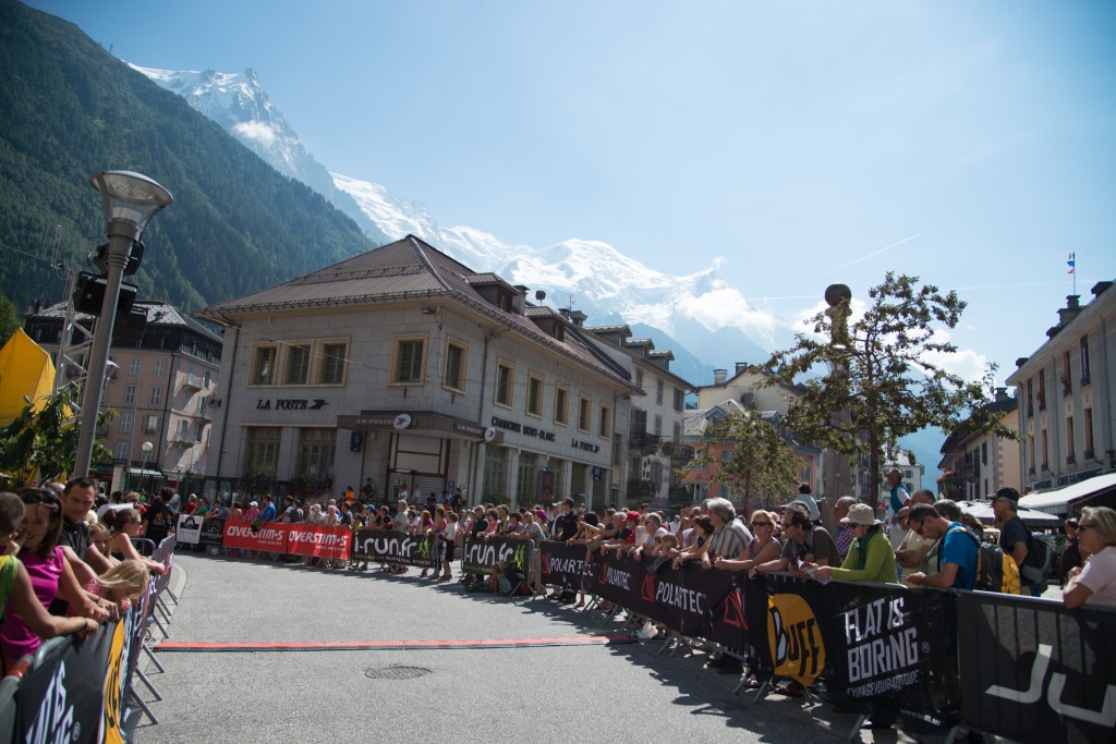
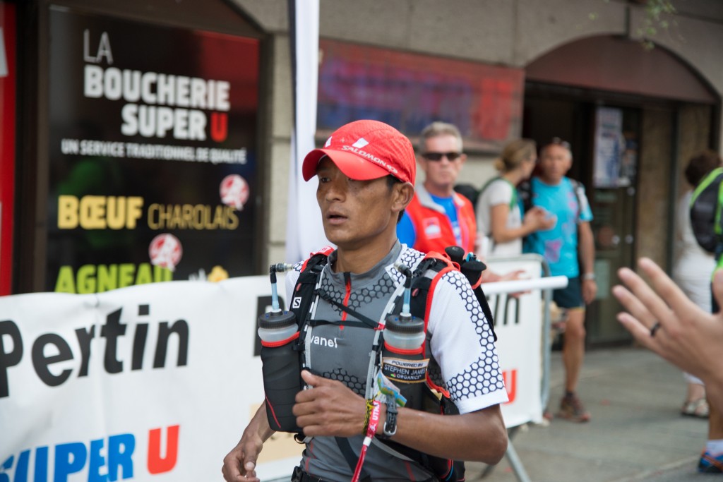
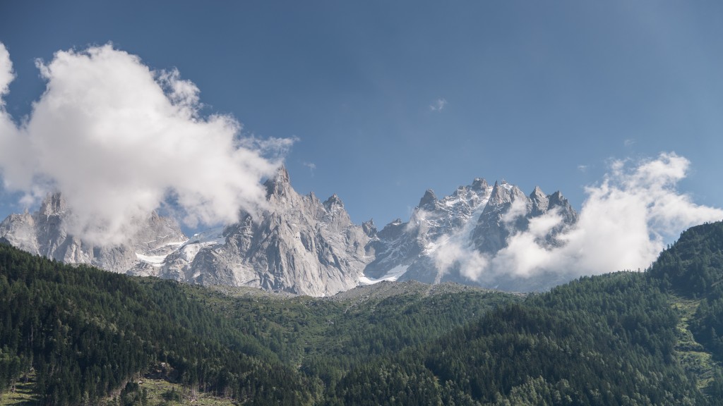
Chamonix is a beautiful area with the very impressive Mont Blanc massif rising steeply over town and dominating the skyline. Our trip overlapped with the tour Du Mont Blanc ultra-marathon, so town was bursting with people and activity.
We mulled around town and took in the sights. At lunch we bumped into another couple from Washington State who were doing a short section of the TMB. It’s always a little humbling to be halfway around the world from home and bump into people from your home state or town.
To help us stay awake, we also grabbed an afternoon coffee and snack while watching some of the marathoners run the final few hundred meters of their 120km journey. For me, it was a little surreal to sit drinking coffee and eating macaroons while watching people who has just circumnavigated Mont Blanc in a day run by.
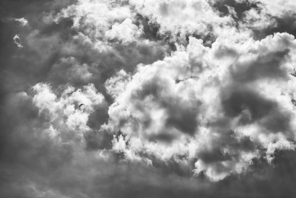
Anne and I did attempt to take a gondola trip up the Aiguille du midi but the gondola had stopped running for the day. I was a little bummed, knowing that I probably won’t get an opportunity to do that trip for a long time to come. But it may have worked out for the best because prices are steep and the late afternoon clouds were starting to roll in.
We settled for just heading back to the hotel and resting, still trying to recover from our jetlag and preparing for the start of our trek the next morning. The Gite does provide passes to local transportation, including bus passes as well as rail so it was easy for us to move back and forth between Chamonix and Argentière. Our room was relatively humble, a double bed that didn’t come with bedding or towels for the shared bathroom and a sink that allowed us to fill water bottles and wash hands and faces.
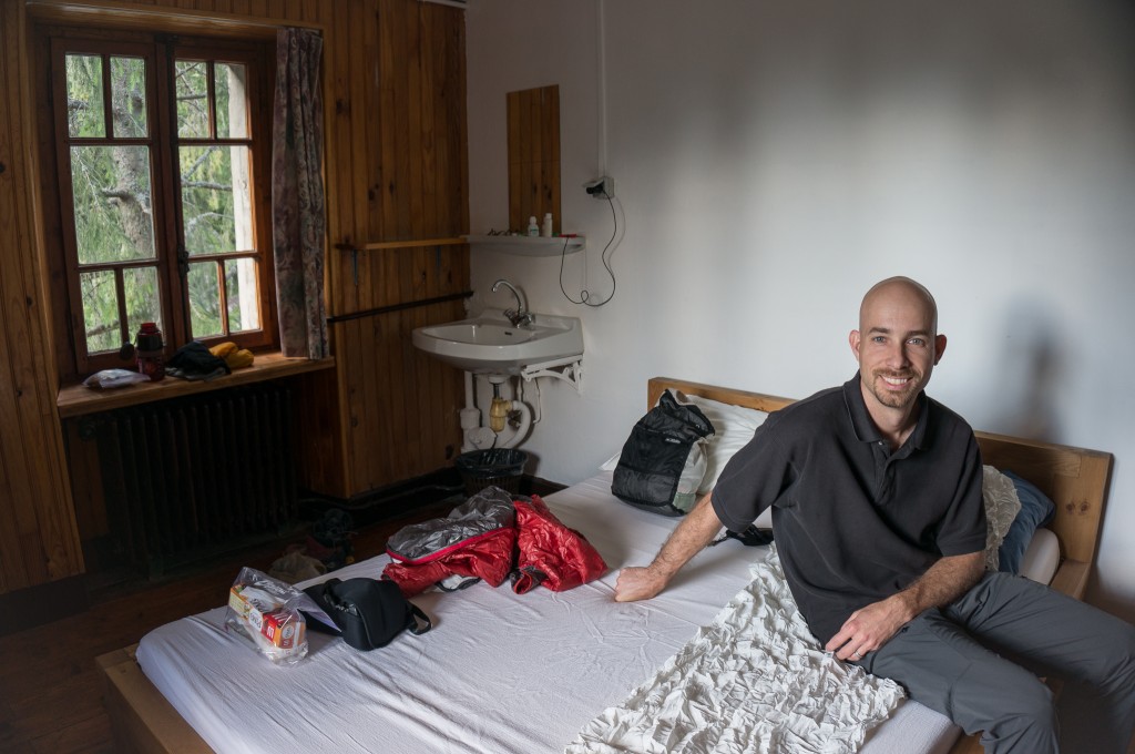
What the Gite didn’t provide in comfort it made up for in hospitality as the hosts were friendly and accommodating, helping us work out the bus schedule as well as ensuring that we had plenty of food at both dinner and breakfast the next morning.
Nov
29
2013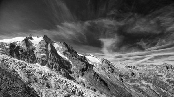
Anne and I recently completed the Walker’s Haute Route in the Swiss Alps. It was a fantastic hike and was filled with spectacular views, wonderful villages, awesome food, and some new friendships along the way. Unlike hiking in the Washington’s North Cascades, hiking in the Swiss Alps offers the ability to overnight from village to village. This allows you to travel light while still enjoying comfortable overnight accommodation and great food.
The Route – An Overview
While the route is certainly challenging, it’s not overly hard and certainly those who are in good physical shape and have moderate hiking experience should have little difficulty if they take their time. There are also plenty of opportunities to take lifts or busses that allow you to significantly reduce the daily burden. We chose to walk the entire route starting in Argentière and avoided motorized transportation so that we’d feel the accomplishment of having completed the route using only human power.
There are at least a couple books that describe the route in detail. The book we relied on, as most others we hiked with, was the Chamonix to Zermatt Walker Haute Route (Cicerone Press) book by Kev Reynolds. The book details each stage and provides alternates for some of the stages. Note that 12 days is probably a minimum unless you want to rush. A couple more days would have allowed a rest day along the way and an overnight detour to the Hotel Weisshorn after Zinal.
Hikers should also be aware that while the route descriptions in the book are accurate, the distance and gain/loss measurements are not. Gain/loss measurements are taken at various waypoints and gain/loss is measured as a difference between those points rather than as an accurate reflection of terrain. Indeed, there are many accounts of this in various blog posts.
Our own GPS data shows that we traveled about 127 miles and gained around 42,000 feet of elevation. We lost almost as much, descending some 40,000 feet. All told, on average we did about 2.1 more miles each day than the book suggested and gained about 645 feet more elevation each day than suggested, with some days gain being off by as much as 1200 vertical feet!
For the data junkies, this all lays out as follows:
Also of interest is the route track and elevation profile, starting in Argentière and ending with the steady walk up the valley to Zermatt. With this view it’s easy to see the general nature of the hike, starting in villages each morning, climbing up to a pass, and then going back down to a village. The large elevation gain starting at mile 30 is the hike from Le Châble to Mont Fort:
Total distance: 122.76 mi
Max elevation: 9826 ft
Min elevation: 2349 ft
Max elevation: 9826 ft
Min elevation: 2349 ft
Good Friends and Travel Companions
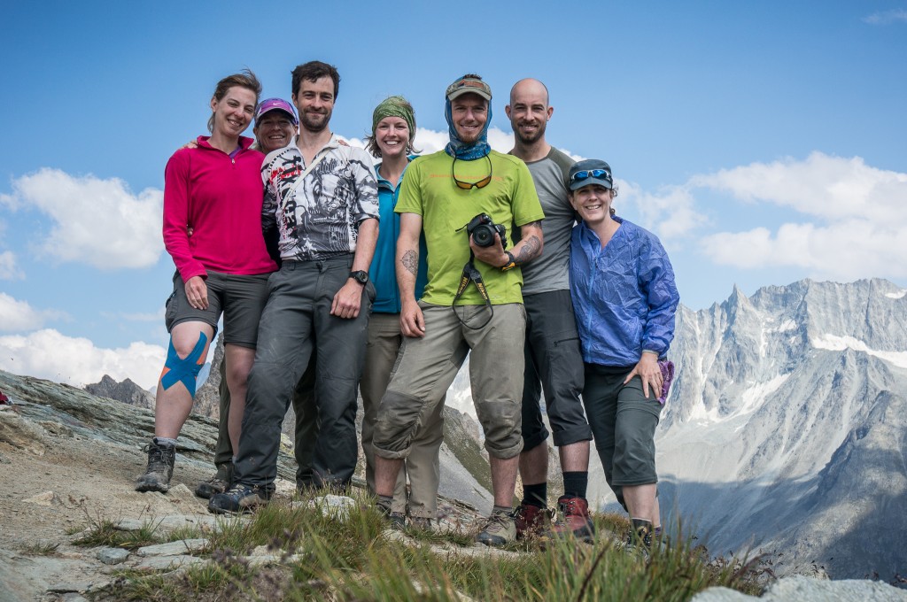
Anne and I had planned the trip as an independent hike for the two of us. This is easy to do and the book provides all the information would be trekkers need to hike alone. But one of the unexpected joys of long distance hiking is the friendships that happen along the way. This happened for us, but to a much lesser extent, several years ago when we trekked to Everest Base camp. For the Haute Route, the friendships we developed along the way were even stronger because the route is relatively fixed and the pace is fairly constant. This gives people lots of time to form bonds along the trail. It also takes a certain type of person to hike a long distance trail, which provides an additional bond.
So while our trip started out as a trip for the two of us, it very quickly became a group affair. We met our travel companions our first night at Hotel de la Forclaz and overheard them as they talked about their hike. When we figured out that they were doing the same trek we were, we introduced ourselves. From there, we crossed paths several times on the trail and by the next night we were eating dinner together as a large group. I think this transformed the hike for me into an experience that was much richer than what it would have been if we’d done it alone.
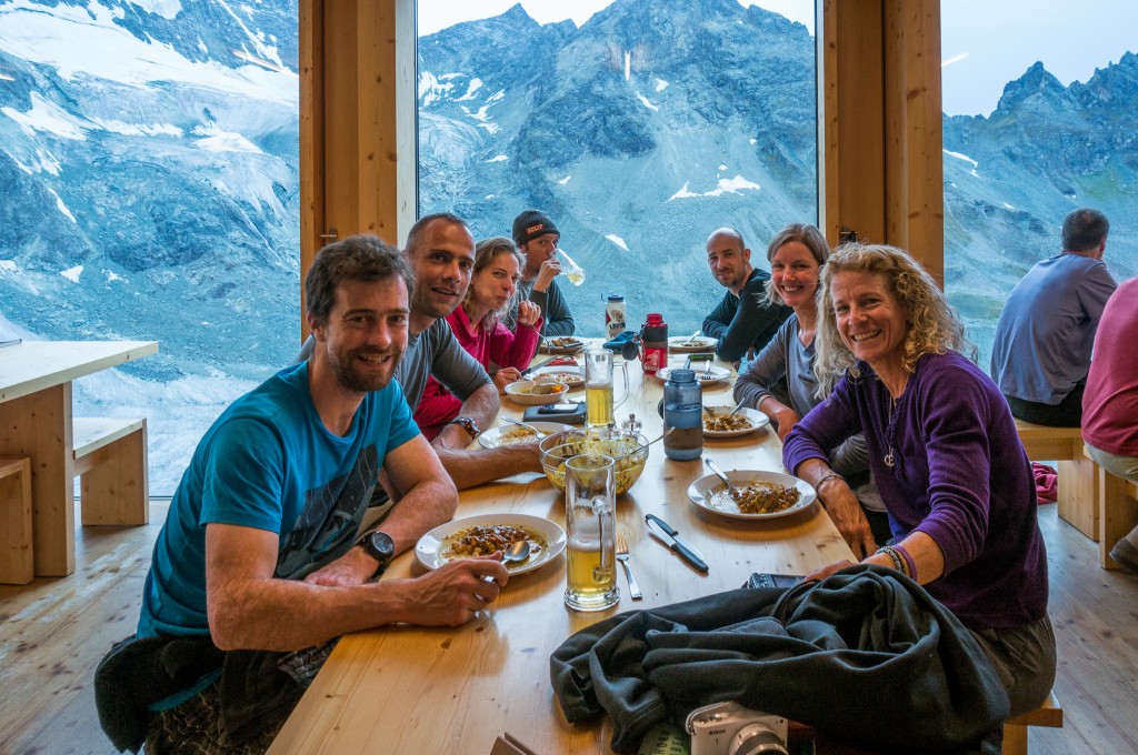
Our group was actually several groups that overlapped at various portions of the trip. Kathy, Val, Rich, Martijn, Anne, and myself formed what I’d consider to be the start to finish core of the group. Neil and Fiona were also with us during the first 3 days of the trek but soon skipped a day ahead. We met Brian, Denise, Aliza, Paul, and Clare on the fourth day and Gareth on the fifth day. Paul and Clare fell behind a day after Arolla (they were carrying full loads with tents, sleeping bags, and cooking supplies). Aliza took a rest day and fell behind a day after Zinal. Anne and I parted with the rest of the group at St. Niklaus choosing to walk up the valley instead of continuing on the Europa Weg.
Our friends made the hike a much more rewarding experience. We shared the trials and tribulations of the day with them, we helped each other out and encouraged each other when we were feeling tired or sore. We ate, drank, and even partied together at a disco in Zermatt. When we parted for the last time, we were sad to leave people who felt like they’d become an integral part of our lives.
Equipment and Packing
Anne and I each carried a backpack and no more. Some of our friends were able to send bags or equipment forward from Chamonix to Zermatt. If you do plan to do this, we heard that the train offers an excellent and cheap option in comparison to the post and is certainly something to be investigated.
We both strived to carry as little as possible, though I opted to carry a DSLR, an extra lens, and tripod which added about 8-10 pounds. All told, my pack weight without water or extra food was 26.2 pounds.
To be on the safe side, we packed our poles, pocket knife, and first aid kit in a cardboard box and checked it with the airline to ensure we didn’t have any problems with security either here in the States or during our layover in Amsterdam. We carried the rest onboard as a carry on. I carried one of the ultralight REI Flash backpacks that we used as a backpack in Amsterdam and Zurich and converted it into a stuff sack during the rest of the trip.
Here’s a list of my packed equipment and a video running through it all:
| Item | Category | Quantity |
| Sun hat | clothes | 1 |
| Handkerchief | clothes | 1 |
| hiking pants | clothes | 1 |
| merino hiking shirts (short sleeve) | clothes | 2 |
| merino hiking socks | clothes | 2 |
| Injinji toe sock liner | clothes | 1 |
| merino thermal bottoms | clothes | 1 |
| merino hiking shirt (long sleeve) | clothes | 1 |
| Merrill minimalist shoes | clothes | 1 |
| camera + 24-120 lens | camera | 1 |
| camera battery | camera | 1 |
| camera charger + cord | camera | 1 |
| tripod + ballhead | camera | 1 |
| wide angle lens | camera | 1 |
| polarizer | camera | 1 |
| remote trigger release | camera | 1 |
| ND Filters + holder | camera | 1 |
| cell phone | elec | 1 |
| cell phone charger | elec | 1 |
| CF memory cards | elec | 8 |
| headphones | elec | 1 |
| outlet adapters | elec | 1 |
| clif shots | food | 2 |
| backpack | gear | 2 |
| blister pads | gear | 6 |
| Nalgene 1 liter bottle | gear | 1 |
| first aid kit | gear | 1 |
| warm hat | gear | 1 |
| gloves | gear | 1 |
| Down jacket | gear | 1 |
| Wind jacket | gear | 1 |
| headlamp | gear | 1 |
| hiking boots | gear | 1 |
| Hiking poles | gear | 1 |
| hiking underwear | gear | 2 |
| moleskin | gear | 1 sheet |
| Small pocket knife with can/bottle opener | gear | 1 |
| Steripen + spare batteries | gear | 1 |
| pack rain cover | gear | 1 |
| pack towel | gear | 1 |
| tent ground sheet | gear | 1 |
| rain coat | gear | 1 |
| rain pants | gear | 1 |
| guide book | gear | 1 |
| sleeping bag liner | gear | 1 |
| sunscreen | gear | 1 |
| One gallon Ziplock bags | gear | 4 |
| passport | misc | 1 |
| sunglasses | misc | 1 |
| wallet | misc | 1 |
| Advil, Tylenol | toiletries | 1 |
| bar soap | toiletries | 1 |
| chap stick | toiletries | 1 |
| deodorant | toiletries | 1 stick |
| ear plugs | toiletries | 2 pair |
| Detergent Bar | toiletries | 1 |
| toothbrush + toothpaste | toiletries | 1 |
Lodging and Costs
Because we also wanted to keep a relatively accurate accounting of our expenses, we also kept records of each place we stayed, the cost, and what was included. These prices are for 2 people.
It’s important to note that we only booked accommodations for our first night in Argentière and our second night in Trient in advance. All other lodging was booked along the way. When booking along the way, we generally tried to call ahead to book the next night and ensure we could find a room. This allowed us to keep our schedule flexible. It also allowed us the ability to coordinate with friends we made along the way so that we could stay at the same place.
Up Next
I’ll be posting for each day of the trip, including photos, route description, and GPS data. Stay tuned!
Oct
14
2013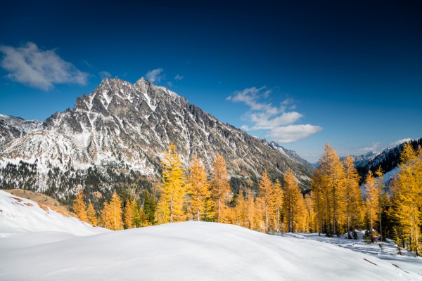
It’s fall in the Pacific Northwest and we’d been hearing and reading trip reports that indicated the larches were in full color. It’s the first time Anne and I have been hiking since we’ve gotten back from the Haute Route and it felt good to pack up our gear and get a day hike to such a spectacular location.
Of course, the word was out and we met up with several hundred of our closest friends at the trailhead who were also making similar pilgrimages to the enchanted land of larches at Ingalls Pass. Fortunately, the trail was well graded and the day was pleasantly warm, which made the hike a good one and we made good time to the pass where we again joined the melee of people and caught our first sight of the color below us.
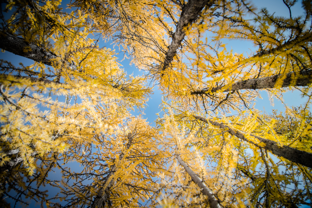
I had some goals in mind for the hike. I wanted to try and capture some images that were not just “taking in the sights” but tried to capture the spectacular color in new and interesting ways. I’ve been interested for a while in trying to make more “painterly” images and so I experiemented with capturing multiple images and combining them into single exposures in camera.


Larch Branch
Jul
09
2012Anne and I took the weekend to get out of the city and do a little camping up in Mt. Baker. The weather forecast was awesome, if not a little hot, and was a great break from the “Junuary” that Seattle has been having. We (Anne) managed to secure a last minute reservation in the Silver Fir campground and with just a little prep, we were off for a nice weekend of hiking and camping.
Our itinerary had us climbing up Church Mountain on Saturday (the bigger day) and then doing Hannegan Pass/Peak on Sunday. Since the Hannegan day was less elevation gain, we figured that would get us back to Seattle at a decent hour.
The trip up Church was relatively uneventful. The path was snow free until the upper basin where there was snow up to the lookout. We dutifully put on our gaiters and pulled out the ice axes and started the traverse across the basin. Since the ridge prevented the prevailing winds from reaching our side of the basin, the hike up to the ridge seemed more like a hike in a blast furnace than the pleasant walk on snow it should have been. However, it wasn’t long before we gained the ridge and made our way to the old lookout site.
Below us in the meadow (south slope) there was a family of five mountain goats grazing on grass. Across the ridge, about a quarter mile away, we could see a mother black bear and her cub grazing in another meadow.

(bears in the meadow)
We ate lunch at the lookout, and I took a quick panorama before we headed down towards the car and a warm dinner that beaconed in Glacier.
The trip up to Hannegan Peak on Sunday involved less wildlife but had other surprises. The trail to Hannegan Pass leads up a long valley that is subject to myriad avalanche slopes in winter. While the trails weren’t in imminent avalanche threat, the aftermath from the winter had left some debris on the trail in several locations. As well, some of the many streams that crossed the path had treacherous crossings. I took a minor tumble down one destroyed creek crossing. Other places the streams were flowing fast and deep, causing us to ponder the best way to cross without getting our feet soaked in the process.
Despite these small challenges, the scenery was wonderful and the early morning shade kept the trip cool and enjoyable. We hit snow just before Hannegan Camp, where we started the march directly uphill to gain the pass and the ridge up to Hannegan Peak. The slope was steep, and I was pretty thankful to have an ice axe for protection.

We finally gained the ridge, took a quick break to cool down (by now the sun was out and the full heat of the day was making itself known), and heading the remaining several hundred feet to the summit, lunch, and the obligatory summit panorama.
The trip down required a little care since we didn’t want to go down the steep snow slope we ascended. Fortunately, we found a more reasonable route through the trees on climber’s right that had the benefit of shading us from the now pounding heat. The rest of the trip back to the car was uneventful, if somewhat hot and dusty. Overall, a great day in the mountains with wonderful panoramic views of Mt. Baker, the Picket range, and the rest of the North Cascades!
Dec
14
2010The alarm was set for 6:30 this morning but like most of the mornings on the trek, we didn’t need it. We’d set up for tea and a Mars roll at breakfast before our 8:30am flight and wanted to make sure we were prepared to go. As it turned out, it was really a rush for nothing. Weather in Kathmandu was preventing (or at least significantly delaying) flights to Lukla.
We waited around, the sort of patient nervousness that accompanies you when you’re not sure exactly when you’re going to need to bolt. The man running the lodge we were at, an uncle of Dorje (Dorje has so many uncles in the region I actually wonder if it was the word he used to describe any sort of general family relation), worked for the airline so as it turned out we were almost the first to know that flights were starting up. It was about 9:30 before we left for the airport where we waited till almost 11 before finally getting on the airplane. Since Dorje knew the system so well, or at least manipulated it to his will, we walked right into the terminal and put our bags first in line, cutting significantly in front of a huge pile of luggage that was headed back to Kathmandu from an Ama Dablam expedition. While waiting, Dorje would walk in and out of the terminal and onto the tarmac drawing a stark contrast between the security at airports in the US and that of the Lukla Airport.
Flights were coming and going in waves, stopping only long enough to unload and load before taking off again. Indeed, the turnaround was so fast that the planes only ever turned off the engine on the passenger side. We hustled out, first in line again, and boarded a Dornier 228. Looking at flights leaving, it appears almost like a carnival ride at takeoff. The airplanes sit at uphill end of the runway, spool up the engines as high as they’ll go, and then launch over the threshold to the 12 degree slope. It reminded me in no uncertain terms of the first drop most rollercoasters have, the slow buildup to the precipice.
What looked somewhat frightful really wasn’t, as we sped down the runway and took off with smoothness that was simply uneventful. The flight was a little more fun since we traveled at relatively low elevation, whizzing past hilltops at barely 200 feet and experiencing the jolts that came with the wind patterns as they blew over the hills. The scenery was great and since there are really no FAA regulations I was able to pull aside the curtain between me and the cockpit and see everything that was going on.
30 minutes after takeoff we’d landed in Kathmandu and now I was wondering how we’d get to the hotel without a trip through Dorje’s living room for tea. AS we picked up our bags and made our way towards the taxi stand, Anne took the lead and told Dorje that we really just wanted to go back to our hotel. He made minor protest so Anne and I figured it would be best to part and make our own way back. We broke out the tips and gave them to both Renche and Dorje. Apparently relieved, Dorje lit up and took off to try and find us a taxi.
No long after, we were back in Thamel where we dropped off Renche (it turned out that Renche lived close to Thamel so he shared a taxi with us) and made our way back to the Hotel Ganesh Himal. We managed to score the last open room, something we’d not figured would be a problem. The room was a deluxe room, with a large King bed and a tub, so by our standards we’d scored big! We had some immediate errands to do, so we ran out to return the sleeping bag Anne had rented from Shona’s, gorged on Mexican food at Northfield Café, grabbed some treats (Mars and Bounty bars and some Pringles), and hustled back to the room where we took hot baths and lounged around for the rest of the day playing on the internet.
All up, it was a great trek. We saw great mountains, had some wonderful cultural experiences, and really just had some good times. Though to make it all roses wouldn’t be right. It was hard too. The altitude takes a toll and the food left something to be desired, especially at higher elevations. The dismal bedding makes it hard to sleep comfortably. Anne and I are both worse off for the wear, hacking and coughing and generally just having some miserable cold like conditions. So we’re really happy to be back in civilization where we can get hot baths, throat lozenges, and toilet paper. After being in teahouses for 20 days, it makes you really appreciate the things you take for granted at home. While I know we’ll eventually lose that sensitivity again, it’s nice to be able to see it so clearly right now.
We’ll take a couple days to recover before we head off for our next adventure, probably taking some time to see the city before we head to Chitwan to try and see rhinos and tigers.
Dec
13
2010Last night turned out to be an interesting one. We’d not really thought much about the lodge we checked into, just that it seemed nice. Around 4:30pm or so, a couple of Exodus groups showed up. It was certainly the most full we’ve seen a teahouse during the entire trek. One of the groups, the “geriatric” group (as deemed by Murray), had only gone as far as Khumjung. The other, far more raucous group had been as far as Gorek Shep and base camp. Nothing of real note happened until after we’d had dinner, when the Gorek Shep group started drinking. It started with a round of beer, followed with some whiskey. From there, the party went on until the wee hours of the morning, with much drinking and dancing and other celebration. Fortunately, we had a room on the third floor of the teahouse and slept soundly through the night, not hearing any of the commotion below.
We were up early in the morning, both Anne and myself now suffering the full effects of the dreaded “Khumbu Cough,” which was really more like a bad and persistent cold. With a sore throat and cough, it made sleeping later in the morning hard. Even harder was getting out of the sleeping bag as it was still quite cold out and with our proximity to the end of the trip, motivation to move fast was starting to leave me. However, we were packed by 8am and had finished breakfast and were on the trail by 8:40am.
The hike to Lukla was a reported 4 hours, making most of the way uphill as the cruel and lasting shot from the Everest region. But the skies were clear, the sun was soon shining in the valley, and it made the first part of the hike to Phakding enjoyable. Anne and I sort of assumed, given the fact that Dorje had family in Phakding, that Dorje would want to stop for tea. We agreed that we didn’t want to stop in advance so when the question came, we said no in unison and said that we’d rather motor on to our intended lunch spot. Next thing we knew, Dorje had again performed his disappearing act. He caught up 40 minutes later as we were taking our time photographing a large complex of mane stones just outside of Nurning.
We finally stopped for tea around 11:20am. Anne really wanted to push on to Lukla before eating lunch. I was pretty sure I wasn’t going to make it so I ordered some soup, which finally forced the issue of food and Anne decided to grab a bowl of soup too. We soon found out that this teahouse was owned by another uncle of Dorje’s who’d summited Everest 3 times himself and had the pictures on the wall to prove it.
After a short lunch break, we made the final push for Lukla. While relatively short, the trail climbs nearly 300m in the final bit to Lukla. Since I’d already mentally prepared to be done the night before, assuming a short day, it made it that much more difficult to push on. Finally, however, Lukla came into sight on the hill above us. After only another 30 minutes of gradual uphill we crossed the “finish line” which Anne and I crossed together, hand in hand.
As is now customary as we get to town, Dorje bolted ahead making for his uncle’s lodge (The Sunlight Lodge). There, he tried to woo us into a double bed room with an attached shower. When I asked the price he said it was 500 rupees. I somehow figured that wasn’t it so I asked about the shower, which as expected cost extra to use. Anne and I pressed that even the most expensive rooms in Gorek Shep were 250 rupees. After some bartering and a little threatening to go somewhere else, we finally got a room with double bed and no shower for 300 rupees. Even though it was a nice enough room, it was hard not to feel like we were being hustled.
Anne and I wanted to look around the town a bit and grab some coffee so we went to find out when dinner was before taking off. It was then that Dorje starting informing us of his plans for us that night. First, we were to all have dinner together. Next, we would talk about the good and bad parts of the trip, giving him feedback on what he did well and not so well. Finally, we would give he and Renche their tips. Along the lines of tips, he went into suggesting the amounts we should tip, for a good guide such as himself (and the good weather) 10,000 rupees and for our porter 5,000 rupees. Anne and I both felt like a line had been crossed.
We went to check out the airport but instead found what appeared to be a town talent show by the airport. We only later found out that this was a once a year event that brought crowds from all over, some flying in from Kathmandu to attend. As we watched, the woman from our lodge danced a Sherpa dance. We only found out later in the evening that it was her, and that she had seen us from on stage! We also found out from her that the event would continue on until the early hours of the morning, getting more vigorous and alcoholic as the night progressed (Dorje actually said that it wouldn’t be safe for us to be out).
Next we had coffee a couple doors down from our lodge, where we determined several things regarding our current situation:
1) We’d never be able to have a fruitful conversation with Dorje about his shortcomings. Especially since his English was one of his biggest shortcomings
2) We really didn’t want to get into the conversation at all and would try and avoid it if possible
3) We would only give the tips out once we got to Kathmandu
We finished our coffee (which was awesome), went back to the lodge, and waited for the inevitable.
A note about the coffee: There’s a “Starbucks” coffee in Lukla. No, it’s not the real thing, but the sign looks nearly identical. It was closed, so we couldn’t try it, but I would have loved to have had a “Starbucks” in Lukla!
Dinner came and I bought a couple rounds of beer for both Dorje and Renche. Since we’d seen other groups treat their guides and porters, it seemed the only appropriate thing to do. This lead inevitably to “the conversation.” At this point, Anne had abandoned me to her new friend Joanna leaving me to chat up Dorje alone. To her credit, she checked in regularly with an inquisitive look to which I could only reply with a sad puppy dog face. Dorje started with lodges… Which lodges were good and which weren’t. To this I had no problem. Both the lodge in Dole and the lodge in Dingboche were duds. Dorje totally appreciated this, telling me he’d not take new clients back there. Then the topic of his service came up. I told him that his English was hard to understand and needed some work. I completely skipped the part about feeling like he’d had his own interests in mind more than ours on several occasions. Dorje, trying to take back the discussion, felt compelled to remind us both of the good weather we’d had and his good service, also then taking pains to invite us for lunch when we were back in Kathmandu (to which neither of us wanted to go).
All the while both Anne and I felt that Dorje was pushing too hard for a tip. Fortunately, I’d managed to dodge the topic of the tip for the majority of the evening. However, it came to a belligerent head later in the evening as Anne, Joanna, John, and I were talking. Dorje made some remark to Joanna and John to be quiet, apparently upset that the four of us were talking. John immediately interjected “What are you on about!?” as I quickly pulled Dorje to the side to grab more water. I reinforced to him that he’d get his tip in Kathmandu, which seemed to quell the immediate issue and make him happy.
Sensing the lull in the mood, Anne and I made for the bedroom, retiring early to pack and get ready for the flight out the next morning. It was good, we weren’t sure how much more we could take, and we’re certainly worried about how tomorrow will go, especially since Dorje wants to have us to his home for tea. For now, we’re packed, ready to go, and dreaming of hot showers and indulgent food…
Stats for the day:
Miles: 5.7
Ascent: 621m
Descent: 583m
Total Time: 4:59
Dec
12
2010Change of plans this morning. We chose to stop short of Phakding to break up the trip to Lukla a bit. That allowed us to get a slow start this morning and check out the gompa and Saturday market, enjoying our time and taking lots of pictures rather than rushing the whole affair.
Dorje had plans for us that were slightly contrary (wanting to do the market first and then the gompa, us wanting to do the reverse) and it was hard as hell getting him around to what we wanted to do in the order we wanted to do it. Finally, we said we’d just do it on our own, specified a meeting time, and took off. Not more than two minutes out the door and along come Dorje and Renche, now apparently having a change of heart. Dorje helped us find the most direct path over to the gompa (a path that involved a lot less up and down) and even though the place was closed managed to get us inside!!! We took a ton of pictures, made a donation, and I even followed along with Dorje as he made a blessing to the lama. All in all, it was a great time.
Next we made our way towards the market on the other side of town. The market was a crazy scene, reminiscent of the sort of chaos you’d expect in Kathmandu. Lodge owners from all over the Khumbu descend on the market to load up on supplies and it’s not uncommon to see yak trains inbound for the market on Friday and leaving Namche on Sunday loaded with goods. Again, we took lots of photos trying to capture the life of the market and the people who frequented it. After we tired of trying to find places to stand where we weren’t in the way, we again made our way back to the Namche Bakery where we both enjoyed a latte before heading back to the lodge for lunch consisting of tomato egg drop soup.
Around 1PM we left for Monjo, saying goodbye to Natang and the Moonlight lodge for the last time. We took an interesting turn that lead us through the market and almost immediately thereafter Dorje was gone. We’d later find out he was grabbing yak butter but assumed he was running some errand for his family up and down the valley. Renche took on the role of guide and the three of us carried on. As we made our way along the trail, we looked back frequently to see if Dorje was catching up but as we reached the valley below it became apparent that Dorje was further behind that we’d all thought.
It only took about an hour to drop the elevation to the valley floor and reach Jorsale. Apparently, Dorje had instructed Renche to get us a room there to which Anne and I both protested. In fact, Anne pressed for Phakding (still another 2 full hours away). Renche looked as though he didn’t quite know what to do, but acquiesced to the request and so we kept moving along. In the end we wound up stopping in Monjo, which was the next major town down the valley. We’d probably have gone further yet had it not been getting late in the afternoon. Because we didn’t know precisely how much longer it would take to get to Phakding and because it was clear daylight wouldn’t last much longer we figured it was better to take what we’d gotten than to push it. Dorje was still nowhere to be seen so we found what looked to be a nice lodge, asked a couple guys sitting on the patio if it was any good, and checked ourselves in. While Anne got the room set up, I stayed and chatted with the two while waiting to see if Dorje passed. Scott was from Canada and Murray was from Australia. Both were hiking along but had paired up after meeting each other on the plane.
After about 10-15 minutes Dorje came trotting along. It was a frustrating experience. You hire a guide to be a guide rather than run personal errands and leave you alone all day. We felt bad for our porter, who’d clearly been put in a position that he wasn’t entirely comfortable with. We resolved to adjust the tips based on the experience, dinging Dorje 1000 rupees for being more interested in his motives than his clients. It wasn’t the first time. On our rest day in Namche it became apparent that Dorje wanted to get a coat at the Tibetan market rather than spend additional time walking to Khunde. That not only resulted in our day being cut somewhat short, but also his racing ahead of us and feeling pressured to keep up at a pace that wasn’t ours. It was also apparent leaving Tengboche as Dorje had wanted to get an unreasonably early start given the distance we needed to cover in the day, again apparently due to some ulterior motive in Namche. All up, we’re starting to feel a little tired having to “fight” to get some of the things we want. Hopefully, it will all be over soon and we’ll be relaxing in warm beds and hot baths.
Stats for the day:
Miles: 2.9
Ascent: 168m
Descent: 756m
Total Time: 2:00


Dec
11
2010Feels like we’re finally on the homeward leg. We left Tengboche this morning for Namche, and then it’s just another day or two to Lukla.
While we were having breakfast this morning, the Sherpa crew got moving along to the funeral. Apparently the back story was that this nun lama, back before she was a lama, didn’t want to get married. She became a nun and meditated for 40 years to gain enlightenment. It apparently resonated with the people because the entire valley is on the move to come to the ceremony. As we headed down the steep path from Tengboche many others were coming up for the service, including whole families with children who must have gotten a really early start.
The path down to the valley was steep and slippery and all of us took turns slipping on the dirt. Renche took probably the most spectacular digger, slipping quickly right onto his butt. The depressing part of the morning was that all of the elevation we lost we then had to immediately gain back as soon as we crossed the river. But, we knew we were closer to the end than not and that helped to lighten the mood if not always the step.
We grabbed tea and Sanasa, where we were finally at the elevation we needed to be at to make the final traverse to Namche. Here we were able to sit on a nice terrace facing the sun and look across the deep valley to Tengboche, only a small elevation above us. I made both our guide and porter laugh by mistakenly using the ladies toilet rather than the mens (there’d really been no previous distinctions for pit toilets, so I didn’t even both looking at the door).
After warming ourselves and drying our damp socks a little, we were back on the trail. It only took about an hour more to reach Namche. Along the way we passed some photogenic chortens and a monument to Tenzing Norgay, the Sherpa who in 1953 along with Sir Edmund Hillary made the first successful summit of Mt. Everest. We took pictures of it all, knowing it was our last good change to take pictures of Ama Dablam and Everest, sad and yet happy at the same time.
About 4 hours after leaving Tengboche, we were headed down the last little hill to the Moonlight lodge where we checked into the same room we’d had on the trek in. Since we got to Namche around noon, we had all sorts of time to stroll about town. We’d heard great things about the Namche Bakery, so we made our way there first. I grabbed an Americano and Anne and I shared an apple strudel. The strudel, as promised, was excellent. After weeks of trekking and eating only teahouse food, the strudel was downright divine. We scarfed it down quickly, resisting the urge to go back and help ourselves to more of the enticing pastries.
Instead, we strolled down to the “bottom” of town to check out the Tibetan market. A semi-permanent fixture, the market takes up most of the main square in Namche. The Tibetan proprietors actually sleep right there, in makeshift tents and tarps. We wandered around looking at all the variations of imitation Mammut, Mountain Hardware, and North Face clothing, piles of fake Adidas and Nike shoes, and all sorts of other stuff. It was boggling to behold, I have no idea how anybody finds anything they might want. From there we wandered about town, stumbling onto the official Sherpa Adventure Gear store and finally the authorized Mountain Hardware and Cascade Design store.
Back for dinner, I indulged in my first beer of the trek. I’d made up my mind when I first saw Everest Beer in the teahouses that I’d needed to drink it along the trek. Since we were now on our way down and at a sensible altitude, I figured it was safe enough and about time to grab a beer and celebrate. Needless to say, it was great and made the perfect pairing with the spaghetti I had for dinner.
Tomorrow the plan is to check out the Saturday market and the local gompa before heading down the Phakding for our last night on the trail. From there we’ll hike out to Lukla for a flight out the following morning.
Stats for the day:
Miles: 5.95
Ascent: 476m
Descent: 814m
Total Time: 4:21
Moving Time: 2:54


Dec
10
2010It was cold when we woke up this morning, as predicted by virtually everyone we talked to. Pheriche is in a valley and doesn’t get early light. As well, something about the way the wind and the clouds form up makes this part of the valley particularly cold. We did our best to get out of bed and stay warm, but even the dining room wasn’t really warm and the hot tea only did so much to warm the extremities. After an extended breakfast to try and stall as much as possible to allow the sun to poke out, we took off.
Pheriche pass was the first destination, we dropped down briefly, crossed over the river, and then enjoyed a quick climb out of town that crossed into the sunlight and helped us warm up. The trek back to Pangboche was uneventful and we stopped for tea at a great little spot in town that was warm and sunny. There we met a couple from Tennessee who were on their way up to Gorek Shep, the southern accent seeming somehow out of place in the Khumbu valley.
We left Pangboche and made our way towards Deboche, which is a short climb below Tengboche. Personally, I found this part of the trail to be inspiring. Before crossing the river over a high suspension bridge, we passed many mane stone walls and chortens with incredible views up the valley towards Ama Dablam and down the valley to the gompa at Tengboche. The trail was full of people engaging in the daily walk of life, old men and women hauling huge loads of wood up the steep path towards villages higher up the valley. Crossing the river high above a water cut gorge, we then passed into rhododendron forests on a nice and mostly flat trail to Deboche.
In Deboche, we stopped for lunch at a nice looking lodge that was unfortunately really cold inside. Anne noticed a post card of Mount Rainier and eagerly explained to Renche and Dorje that she’d climbed it. Dorje seemed impressed, both of the climb but more so seemingly about the fact that there were no fixed ropes! Proud, Dorje passed along the accomplishment to the lady working the kitchen, who was also impressed.
Climbing out of Deboche, the trail headed uphill sharply following an old “paved” road. Dorje had told us the hike up to Tengboche would take about 40 minutes. Anne put on a tear and made short work of the steep section, topping out in Tengboche a short 20 minutes later where we checked into the Tengboche Guest House. Most of the land here is owned by the gompa, and so our lodge was actually part of the monastery. We landed our bags, went outside and warmed ourselves in the sun a little, and went for tea while waiting for the monastery to open at 3pm for pictures. While grabbing tea in the dining room, we were shocked to find Natang, the owner of the Moonlight lodge that we stayed at in Namche, sitting right beside us. When asked what he was doing there he casually replied “Sherpa trekking.” In reality, the Tengboche Guest House was owned by his brother in law. More than a friendly family visit, we later found out that people from all over the valley were converging on Deboche for the funeral of a lama the following day. Natang asked us about our trip and we told him how it had been going, also telling him that we’d be back in Namche at his lodge the following day.
At 3pm we went to the gompa for pictures. We had really hoped for chanting, but that didn’t happen. So we resigned ourselves to the pictures we could take, wandering inside and out taking pictures of anything and everything that inspired and making plans to come back at night and try and do a little night photography of the place (one of the very few things that was lit at night in the valley).
Just before dinner, a large group of the owners friends showed up from Namche transforming the dining room into a bustling hub of activity. This group too was in town for the funeral. Beers and wine were broken out and all of them chatted vigorously for the rest of the evening. Dorje sat off to the side, clearly an outside to this party and seemed in some ways frustrated that he wasn’t the center of attention. We ate our dinner and watched the show before us, wondering how much of this was “normal” life when us westerners weren’t around. Dinner itself was again excellent. Anne wolfed down a vegetable curry with rice (though not as good as the previous night’s egg curry) and I helped myself to a couple helpings of dal bhat.
After dinner we made our way outside, tripods in hand, and did some night shots of the gompa. I stayed out a little past Anne, tromping around the sloping fields to try and find some better angles from which to photograph the gompa and stars. It’s clear my night photography skills need honing as I didn’t really come away with any keepers, but just the experience of being outside and being able to look up into the night sky where there is so little atmosphere above you and virtually no light pollution is incredible. I took as much as I could in, and made my way back to the warmth of my sleeping bag.
Stats for the day:
Miles: 5.5
Ascent: 347m
Descent: 727m
Total Time: 5.01


Dec
09
2010We woke this morning with the weight of trekking to Everest Base Camp weighing on us. Anne had another bad night of sleep and at one point I was really quite worried about her safety. We quickly decided that base camp wasn’t in the cards, though it was a particularly tough decision for Anne as it was one of the primary objectives of the trek. The reality is that Everest Base Camp is really just a bunch of prayer flags on a glacier that involves a long slog to get there. After the view from Kala Patthar yesterday, it seemed that base camp would be a letdown. Plus, given the pace at which Anne is now traveling due to her breathing difficulties, the round trip probably would have taken close to 4.5 hours and hence endangered our plans to make Pheriche that evening. So we ate breakfast and headed down the valley rather than up it.
We made slow progress to Lobuche where we stopped for tea. Anne ordered mint tea, which was confused for milk tea, so I swapped my hot lemon for hers and also grabbed her camera to put in my pack, thus helping reduce her load. As we descended, progress became quicker and by the time we were in Thukla for lunch, Anne was hopping along much more quickly, with less coughing and hacking.
At lunch we ran into basically the entire contents of our lodge in Gorek Shep, all headed to Pheriche for the night. We also met two Irish men heading up to climb Lobuche peak. They found a friend in Dorje, who started giving them beta on which camp to make and some limited details of the route.
The last bit of downhill to the lower valley went quickly, with Anne passing people as we dropped in altitude. In the valley, we spent time taking pictures of a summer yak station with its rock walled pastures and flags. It was just another 15 minutes to town where we checked into the Pumori Lodge. It was a nice place on the far side of town. The place was huge, clearly designed to hold the large crowds of the high season, though only contained 2 or 3 parties for the night.
Anne was in good spirits and we listened to audio books together, sitting side by side in the dining room basking in what remained of the sunlight. As a nice touch, the host served us warm hand towels before dinner to wash off our hands. It was unexpected and it really set a great mood for the evening. For dinner, Anne had egg curry. This was notable because Anne proclaimed it to be the best egg curry in Nepal. As she’d not really eaten much for the past several days I was delighted she’d finally found a full meal she wanted to finish.
Tomorrow we’re off to Tengboche, which should be around a 4 hour trek. Tengboche sits on a ridge overlooking the valley and is host to a large gompa. Families from all over the Khumbu send their children here to study so we’re hoping for some great photo opportunities!
Stats for the day:
Miles: 6.8
Ascent: 148m
Descent: 1002m
Total Time: 6:13


