Dec
06
2014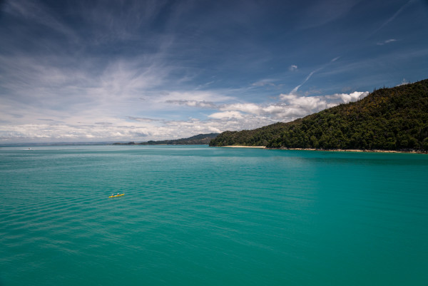
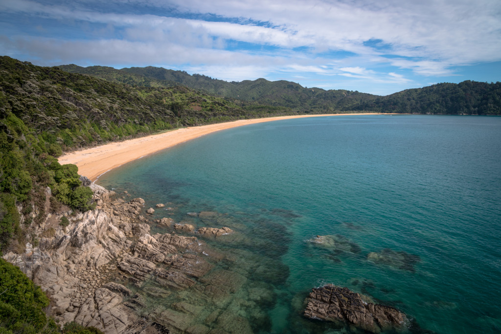
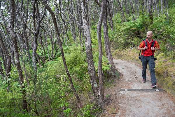
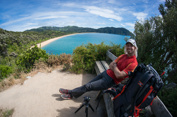
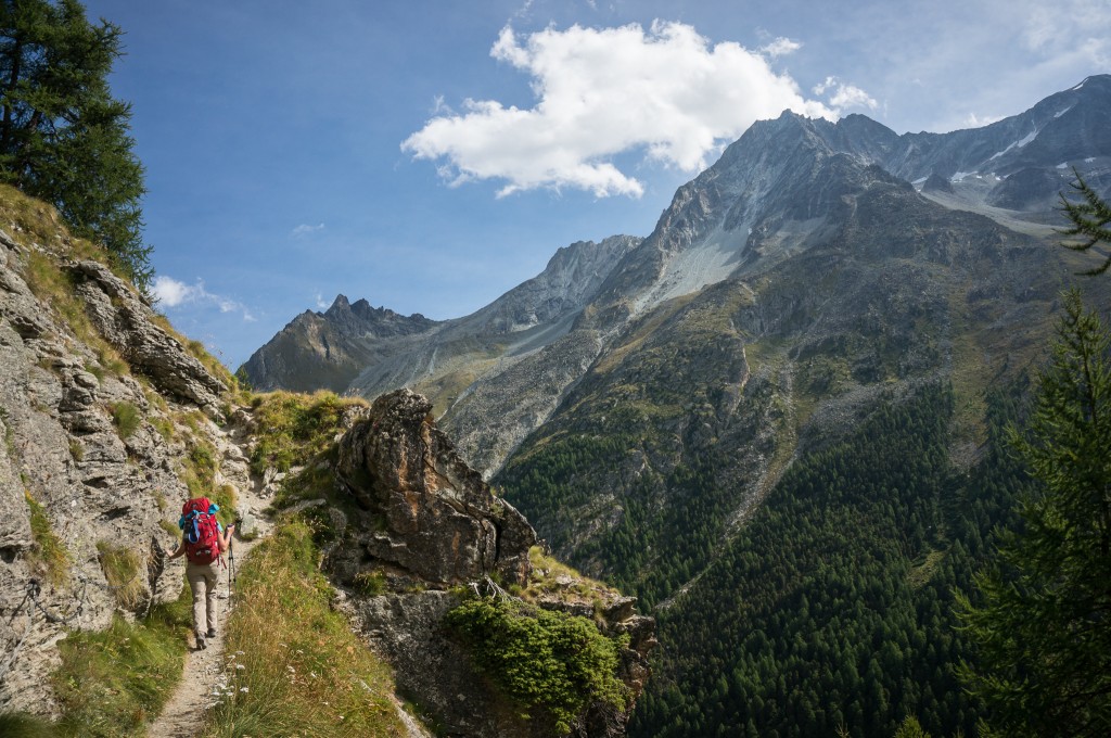
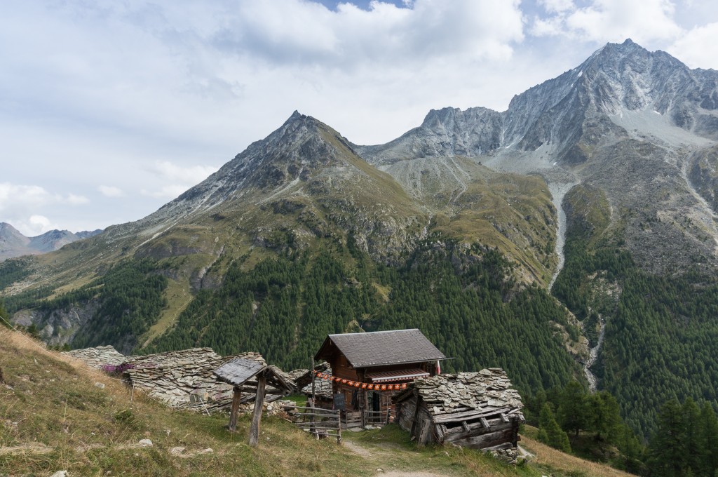
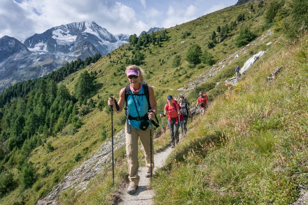
There are several “Great Walks” in New Zealand that receive very positive reviews in guidebooks and online. The Abel Tasman Track is one of these walks that generally receives “not to be missed” praise. It is in fact the most popular Great Walk in New Zealand. Located in the Abel Tasman National Park on the South Island’s northwest coast, the walk extends roughly 56 km from the start at Marahau to the end of the track at Wainui. Anne and I did a shortened version of the trip over 4 days in December (6-9) from Marahau to Totaranui covering 41.4 km.
(photo by Anne Archambault)
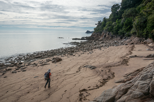
The track mostly follows the coast line, sometimes on beach but mostly on very well maintained trails in the forest overlooking the Tasman Sea. The myriad streams and small canyons along the way are bridged — some with impressive suspension bridges. In two places, there are relatively significant tidal crossings that can only be done within an hour or two of low tide.
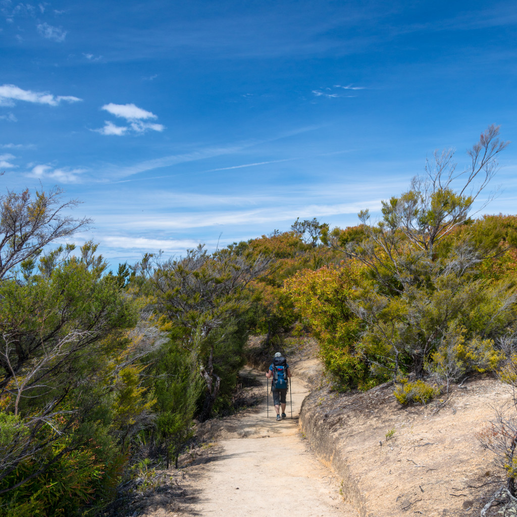
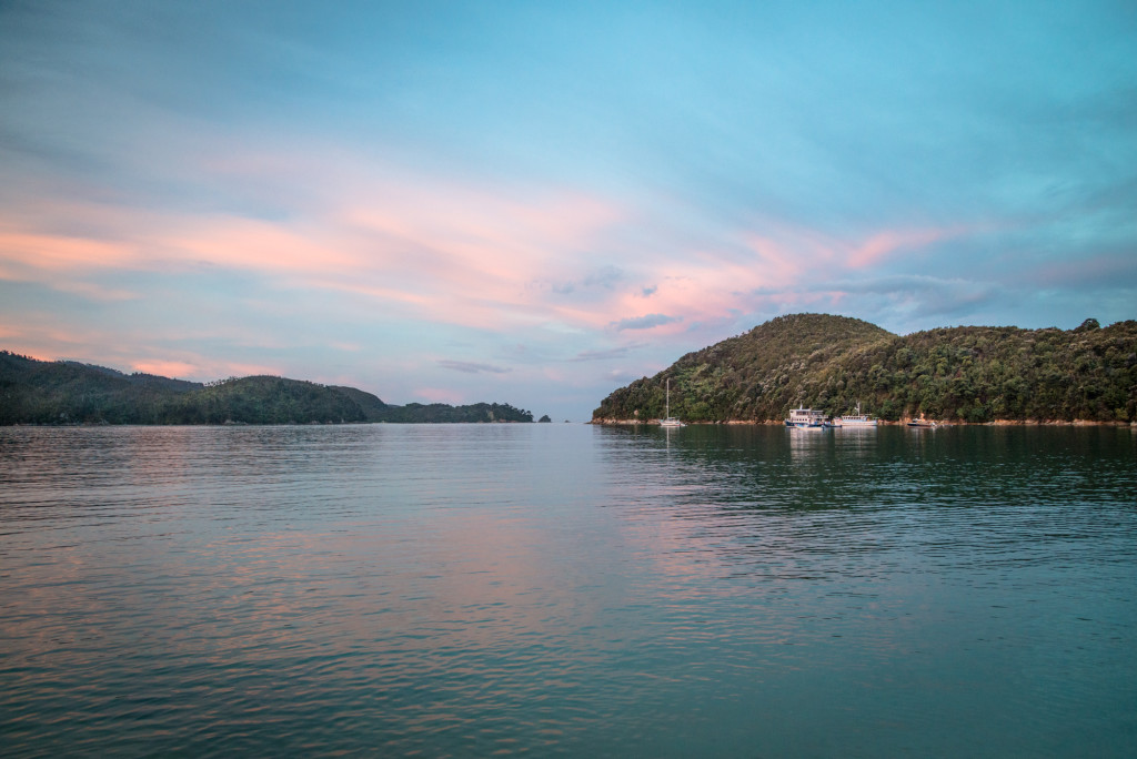
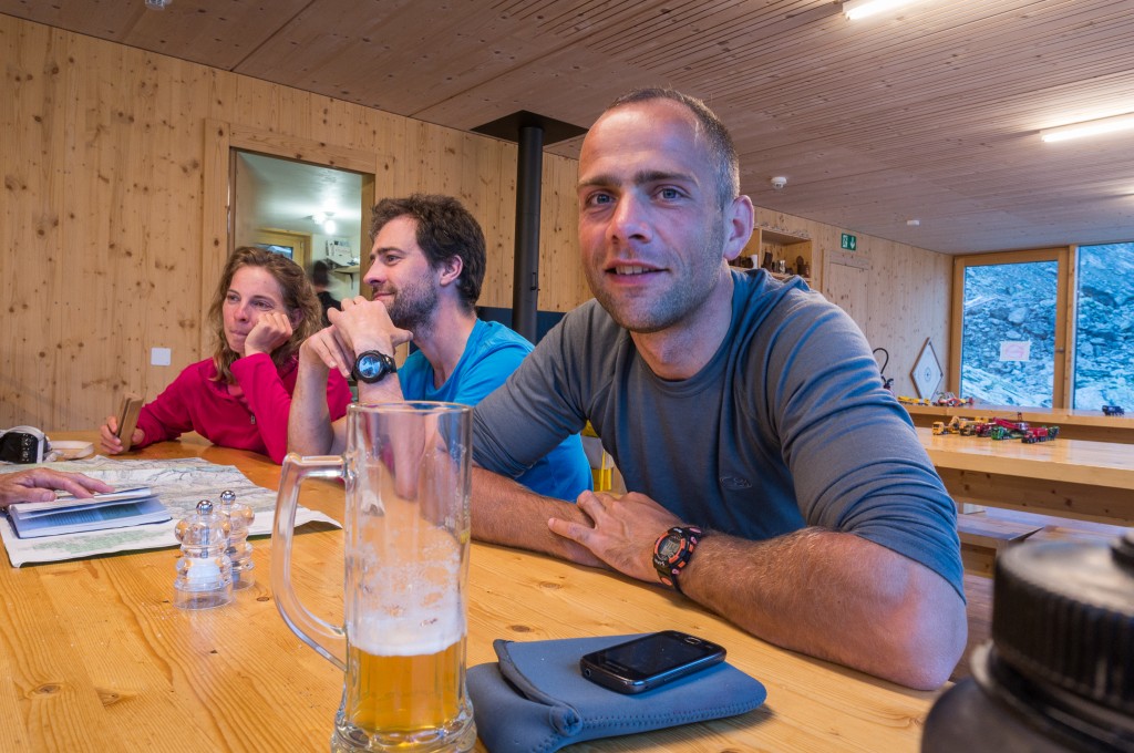
Overnight accommodation is provided in both Department of Conservation (DOC) huts as well as campgrounds. The huts must be booked well in advance and provide drinking water, toilets, and sleeping pads in bunk style dorm rooms. The length of the track (through Totaranui) is serviced by water taxi, which allows hikers to access any point along the trail easily. This is a blessing and a curse, it allows for myriad options to explore the trail, but also allows scores of day trippers to visit huts and campgrounds that would otherwise be 2 days from the trailhead.
(photo by Anne Archambault)
Beaches and Beautiful Blue Water
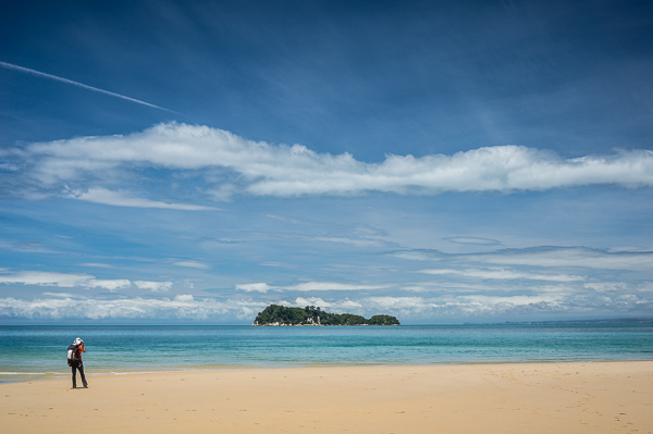
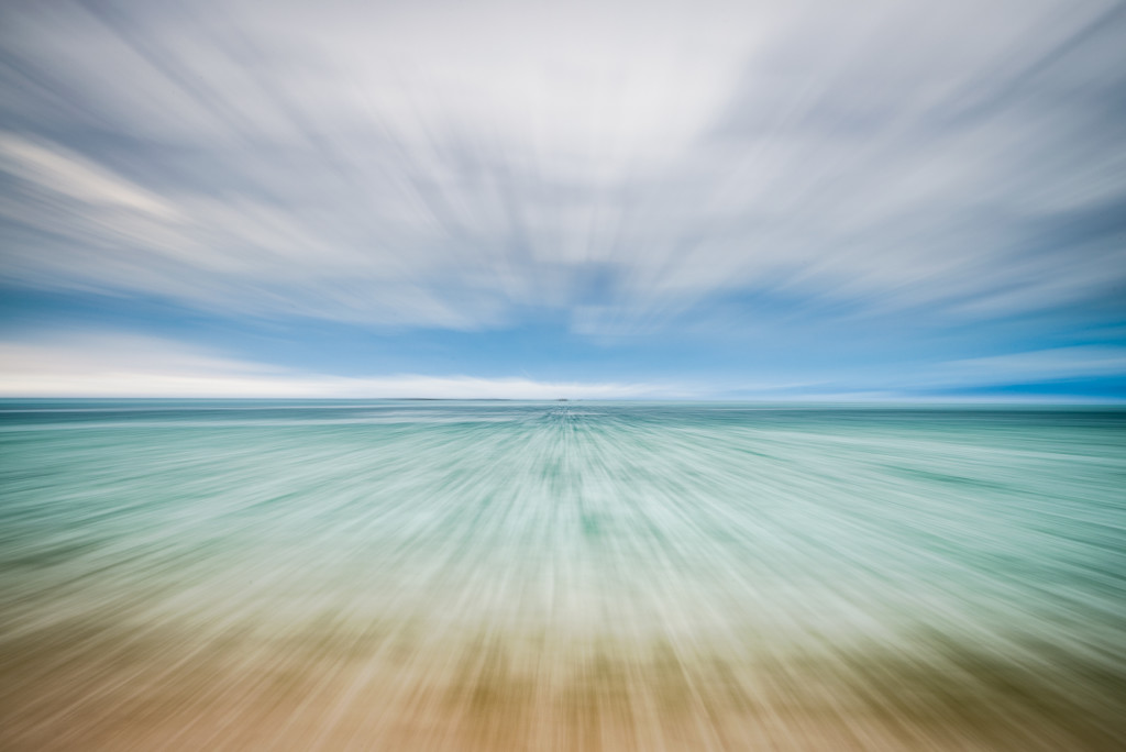
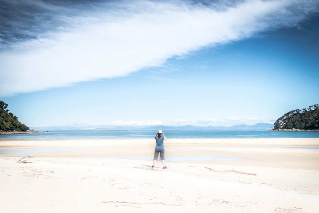
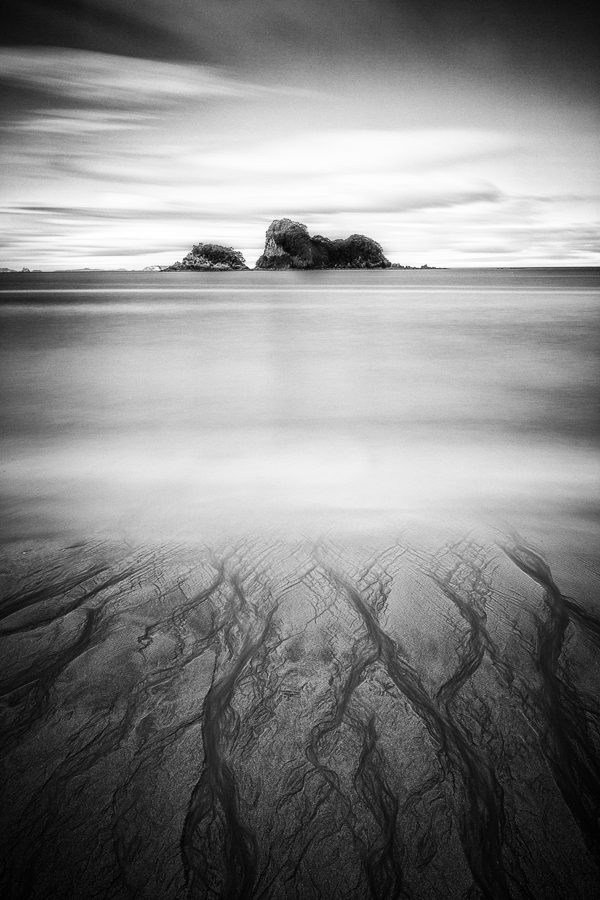
The highlight of the track is the proximity to the beautiful beaches and pristine blue water of the Tasman Sea. Without knowing better, it would be easy to mistake the coastline for beaches in Thailand or Hawaii.
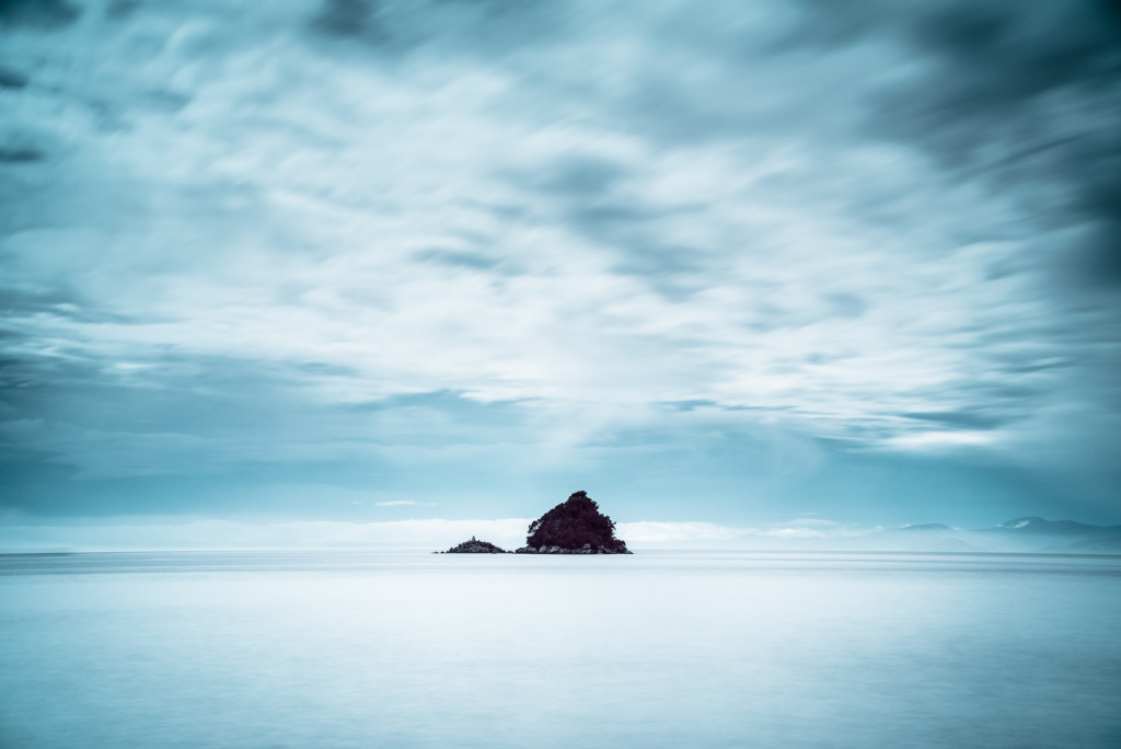
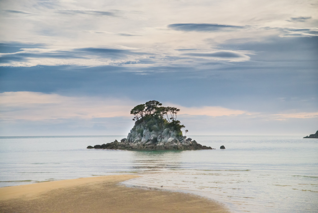
In some places, rocky granite outcroppings form small islands just offshore. These provided a wonderful opportunity for us to take a break from the walk and pull out the camera gear. We didn’t use the tripod often, but in these cases it was very handy for long exposure compositions.
Because of the way the hike is laid out, Anne and I were generally able to complete our hike by early afternoon, giving us plenty of time to rest and relax at the hut. Alternatively, many hikers took the opportunity to stop along the way at secluded or otherwise wonderful beach locations and relax.
Of course the beaches also provided wonderful sunrise and sunset photography. At Anchorage Bay, we had to be up at 5am to make the tidal crossing and were able to watch an amazing sunrise bloom over the hills.
Wildlife
The national parks we visited on the South Island all had robust conservation efforts in place to help protect indigenous species. Invasive species such as possums, rats, and stoats have decimated the native bird populations. Along the track are literally hundreds of traps designed to kill these predators.
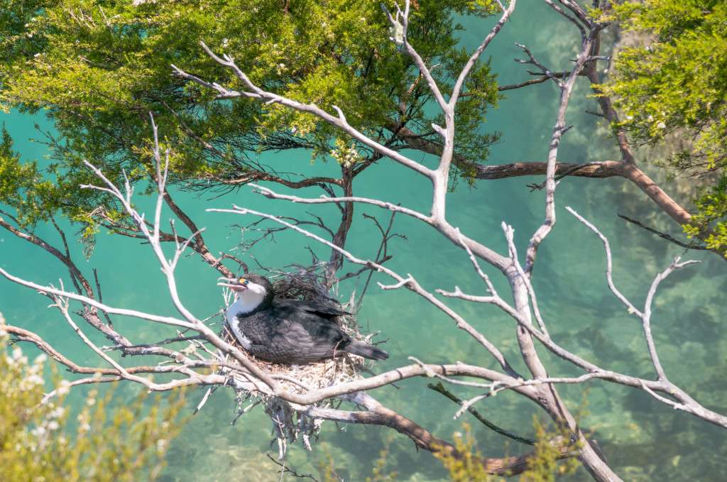
Many of the islands visible along the track are sanctuaries where native species can nest in relative safety. There is also the Tonga Island Marine Reserve to help protect dolphins, seals, and the many native species that inhabit the diverse system of waterways, estuaries, and bays. Fur seals come here to lay their pups and penguins sleep along the rocky headlands.
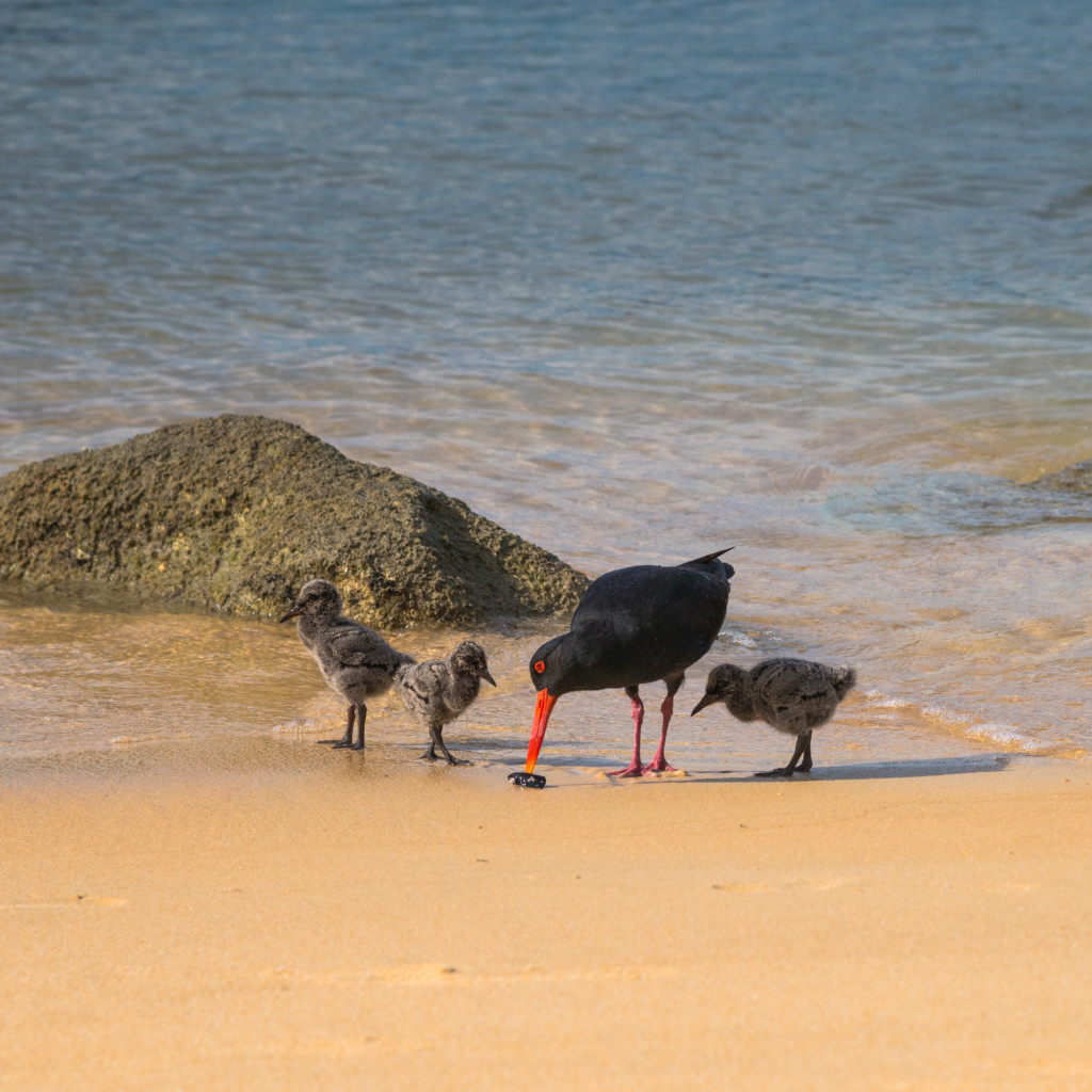
Because we were walking the track in the southern hemisphere’s summer, we were also able to see a lot of young chicks. At Anchorage Bay, a pair of variable oystercatchers had a set of three chicks that allowed us to approach during low tide.
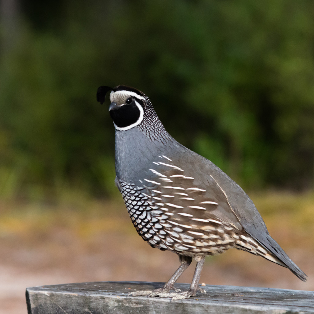
We also saw many of the native quail, some with broods as large as 6 or 8. Some of these quail were quite tame and even posed a little.
Incredible Flora
It’s hard to discount the incredible flora of New Zealand. In Abel Tasman National Park, the forest is dominated in the undergrowth by ferns both small and large. Tree ferns and beech form the bulk of the forest canopy, punctuated by fragrant flowering manuka trees (famous for their honey).
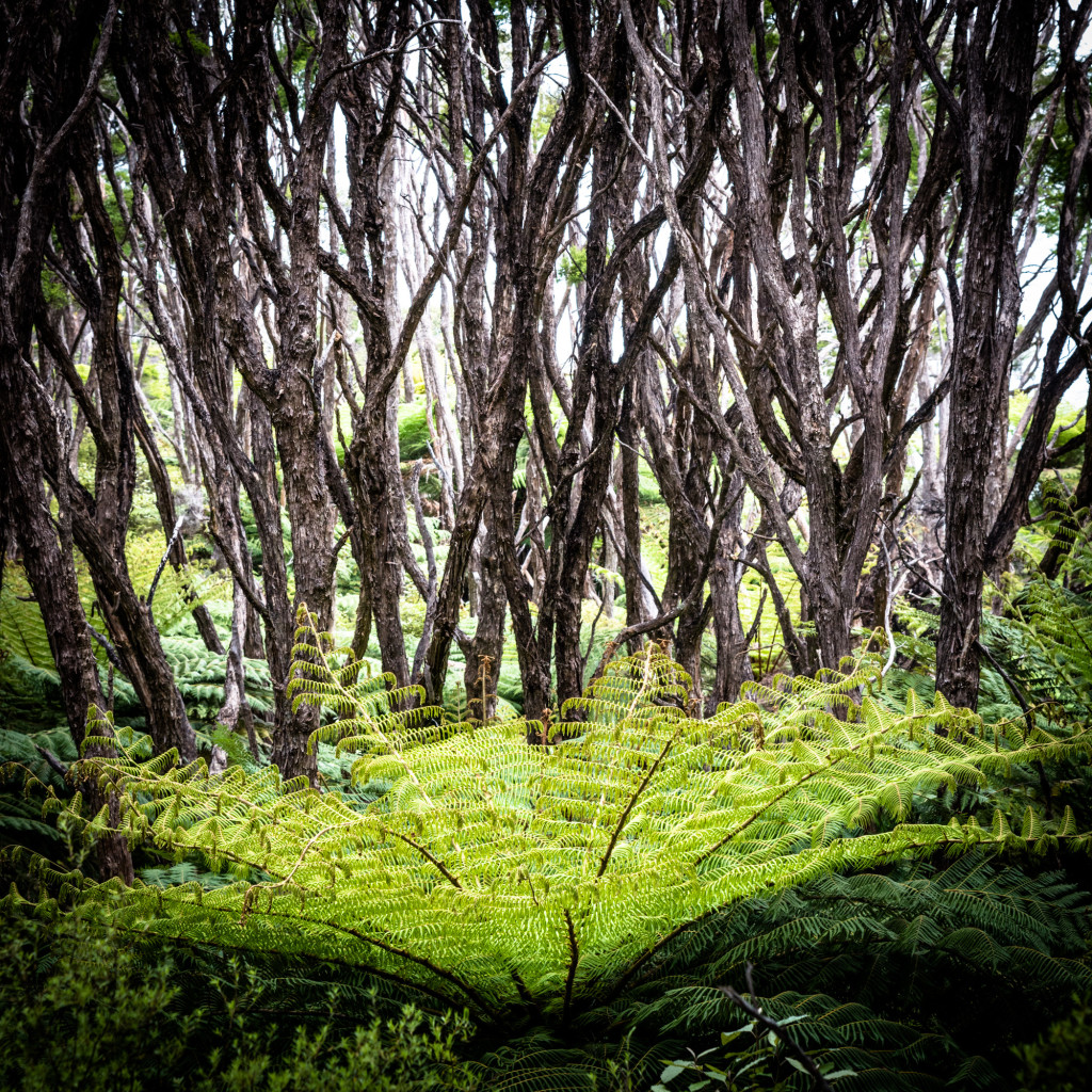
The ferns lend a prehistoric feel to the forest and you could be forgiven for thinking you might be walking on the set of Jurassic Park. In fact, we talked to one person who was sure they filmed some scenes from the movie in the park.
(photo by Anne Archambault)
Should you go?
In short, yes. The trail is fantastic, the days are short, and the scenery is well worth it.
The trail is a little more crowded than other tracks, both because of the relative ease and the easy access. It’s a great warm up for longer or harder walks and it’s also great for families (of which we saw many).
(photo by Anne Archambault)
And who could argue with lots of time on the beach? Anne and I both felt like 4 days was plenty; it provided enough time to get into the backpacking groove without feeling like we were spending more time than we should (the south island is big, we didn’t want to miss anything).
Total distance: 29.09 mi
Max elevation: 385 ft
Min elevation: -283 ft
Max elevation: 385 ft
Min elevation: -283 ft
Dec
03
2014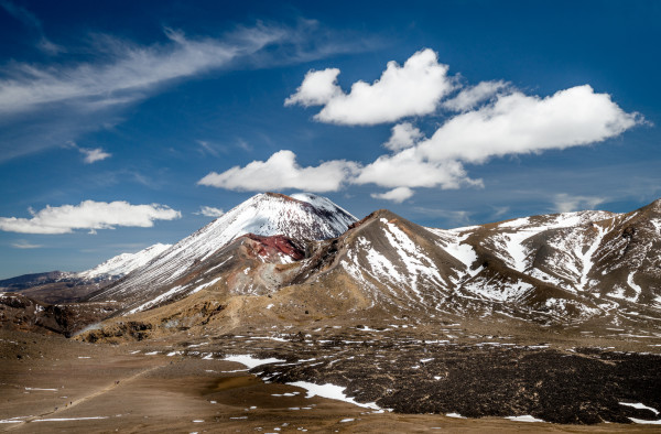
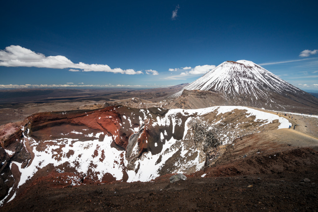
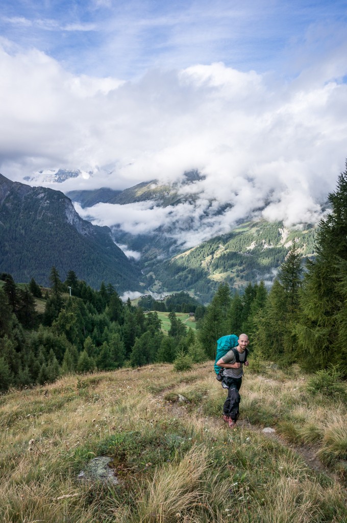
As part of our vacation in New Zealand, Anne and I had a set of “Great Walks” planned. One of those was the Tongariro Northern Circuit that circumnavigates the beautiful volcanic cone of Mt. Ngauruhoe (also known as Mt. Doom in the Lord of the Rings movies). The Northern Circuit is normally a four day walk serviced by DOC huts. However, the weather forecast for the days we had booked was terrible; gale force winds, rain, and a low cloud ceiling which would have precluded any views of the mountains. So we changed plans, looked for a weather opening, and did the one day crossing instead.
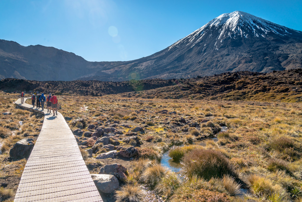
The Tongariro Alpine Crossing is billed as one of the greatest day hikes in the world, and I think Anne and I would be compelled to agree that it’s certainly high on the list. Between the well maintained trail and the incredible views it really is a winner. The only drawback was the sheer number of people also doing the crossing, which on the day we made the crossing must have been in the hundreds.
The hike from the trailhead up to Soda Springs crosses sub-alpine scrub, following the course of a small stream. The trail here is exceptional and well graded with many areas having full boardwalks. Views up to Mt. Ngauruhoe only improve with each step.
From Soda Springs, the trail climbs steeply up to the South Crater entrance. While steep, this path is still excellent with most of the trail formed into actual stairs. Gaining in elevation, we were able to see Mt Taranaki standing sentinel over New Plymouth some 50 or 60 miles distant. The trail quickly gains elevation, traversing the flank of Ngauruhoe and entering the South Crater where the summit path up Mt. Ngauruhoe branches off.
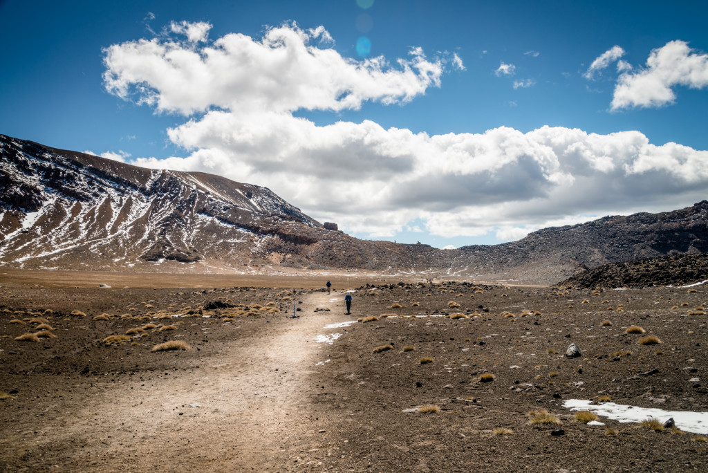
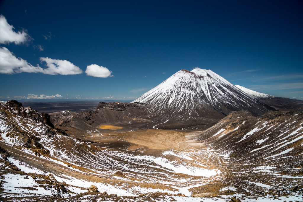
The Alpine Crossing trail continues across the South Crater, which is actually thought to be an in-filled glacial cirque rather than an actual volcanic vent where it climbs again, more steeply, to gain the top of the red crater.
[jwplayer mediaid=”1665″]
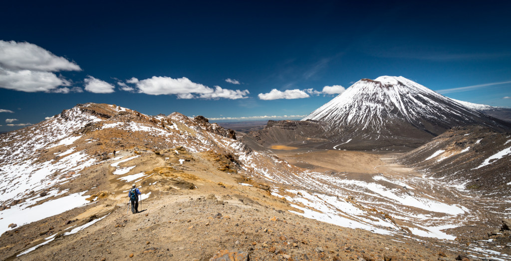
Anne and I took the side trip to the summit of Mt. Tongariro. This was a relatively short detour with limited elevation gain but it provided extraordinary views over the South Crater and across to Mt. Ngauruhoe. The summit rewards hikers with outstanding views in all directions. I think it’s a detour that should not be missed.
Back on the main trail, the path climbs slightly to a viewpoint over the Red Crater before descending steeply down a very loose volcanic scree slope to the Emerald Lakes.
Hikers should take note that at this point the hike is about halfway done, though virtually all of the uphill has been completed.
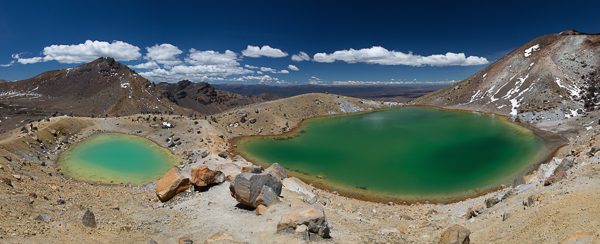
A hike across the Central Crater followed by a short climb brings hikers to Blue Lake, which is actually another crater that’s about 9700 years old. This serves as a wonderful vantage point back across the Central Crater and Mt. Ngauruhoe, which is now partially occluded by the Red Crater and the shoulder of Mt. Tongariro.
The rest of the hike from this point is relentlessly downhill to the Ketetahi Car Park. The trail passes through the active volcanic zone of Te Māri crater where an explosion in 2012 left a hole in the Ketetahi Day Shelter that is still on display.
From the shelter to the car park the trail winds first through alpine scrub before descending into the trees of the forest. This section of the hike is much longer than it appears on paper and should not be underestimated. We were only just able to make our shuttle pick up time 8.5 hours after drop off because we didn’t appropriately estimate how long this last section of the trail was. It should also be noted that even though signs posted times that showed us as on track, these didn’t seem to accurately reflect the time/distance towards the end of the trail. All that to say, if you do the crossing, factor in a little buffer.
In all, the Tongariro Alpine Crossing was a fantastic day hike. It’s certainly worthy of a top mention for all the day hikes we’ve done in the world, though whether or not it occupies the top slot needs some consideration.
Total distance: 14.63 mi
Max elevation: 6457 ft
Min elevation: 2574 ft
Max elevation: 6457 ft
Min elevation: 2574 ft
Nov
26
2014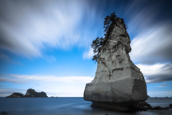
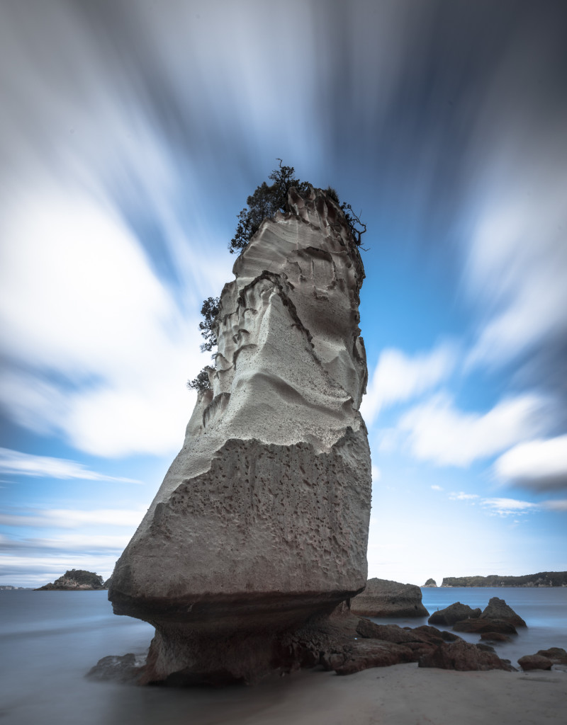
Situated on the Coromandel Peninsula, Cathedral Cove offers sea stacks and a large archway that connects two beaches. Images taken here at the right time (the beach faces east) looked incredible online. Unfortunately, our schedule didn’t really allow for photography at the extremes of the day so we did our photography in the late afternoon.
(Photo by Anne Archambault)
The cove is about a 45 minute hike from the car park, with various detours for other beaches along the way. The track provides glimpses of the spectacular coastline and the blue water below it. Walkers can do this hike in flip flops.
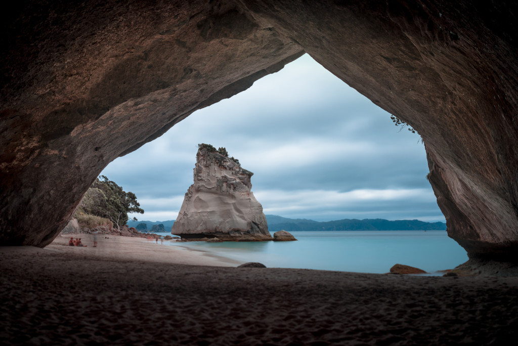
Cathedral Cove is broken into two separate beaches separated by an archway. This hole in the rock is about 150 feet across, so it’s not a trivial sea cave. On either side of the arch are beaches with their own interesting sea stacks. At the south end of the cove is a small fresh water waterfall and public toilets.
Despite being later in the day, we saw lots of photographers, beach goers, and a couple kayak tours while we were at the beach. It was a lovely place to see and one that I wish I’d been able to dedicate more time to.
Nov
25
2014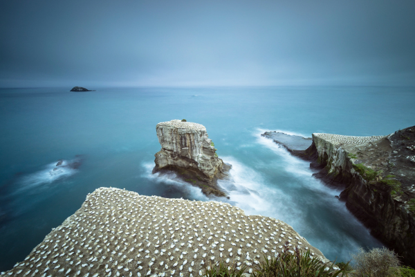
Anne and I took our first full day in New Zealand to drive to Muriwai and visit the gannet colony there. There were some pretty spectacular photos in various blog posts that we both saw, and since it was close to Auckland where we had a couple days to get adjusted, it felt like a perfect day trip.
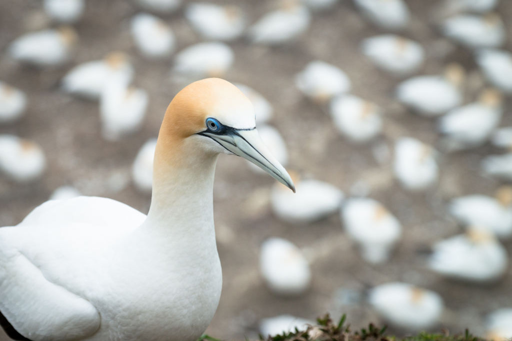
I’d seen gannets before in Iceland, but I’d not visited a proper seabird colony since Anne and I cruised the Galapagos. Colonies such as this are vivid because of all the sights, sounds, and smells (a caution here, the smell isn’t pleasant if you happen to be downwind).
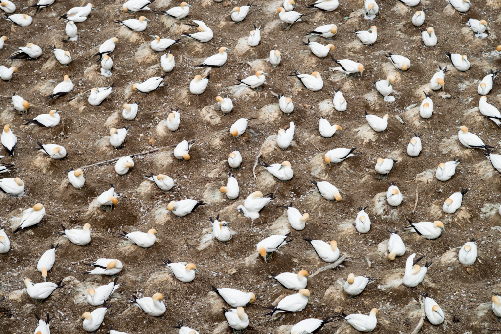
This colony is situated above Muriwai beach on a very photogenic bluff and sea stack. The birds naturally form evenly spaced nests to ensure they are out of nipping distance from their neighbors, which creates nice symmetry.
(photo by Anne Archambault)
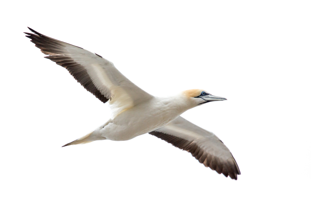
The birds are constantly coming and going, and in this case flying past the view point sometimes as close to 5 or 6 feet. These birds aren’t particularly shy, probably due to the sheer number of visitors on a daily basis. Conditions on the day we visited were overcast and rainy and we still saw close to 40 people.
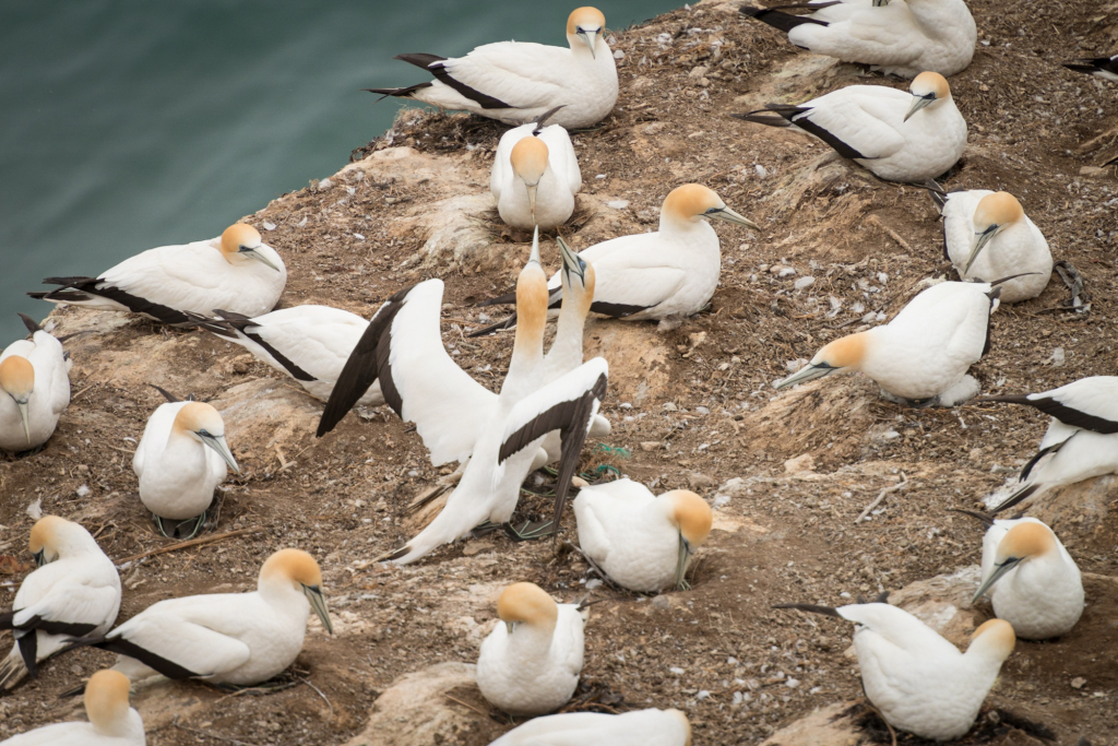
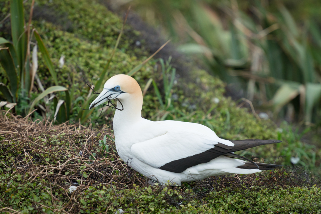
Gannets mate for life and come back to the same spot year after year to raise their young. When the young gannets get large enough to fly, they head to Australia where they tool around for a couple years before returning to the colony to find a mate, secure a nesting spot, and rear their own young. Parents take turns with the chicks, and when a mate returns the pair does what can only be described as a small reunion ceremony of head bobbing, beak tapping, and nodding.
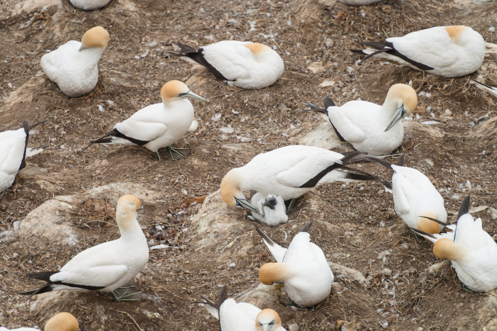
Most nesting pairs we saw had eggs, and a small number already had chicks. Others were gathering supplies for their soon to be nests.
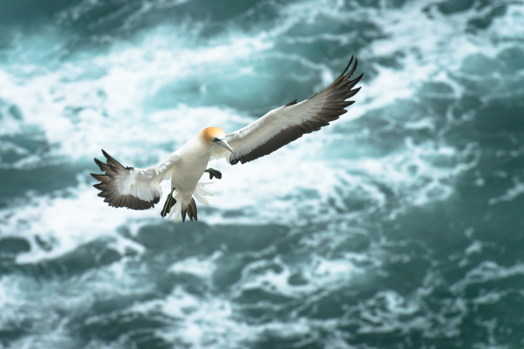
Like albatross, gannets aren’t very well coordinated on land. On more than several occasions, birds taking off flopped through other nesting birds, receiving pecks along the way until they could throw themselves off the side of the cliff and take flight. Landing was slightly more graceful with birds landing almost directly atop their nests. Gannets at the edge of the cliff must have held prized nesting spots because these were easy to both land and take off from.
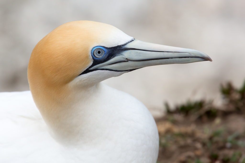
It’s hard not to be captivated by these birds. Their yellow head with blue eyes make for a striking image. One particular gannet landed quite close to the viewing platform and proceeded to preen itself for 15-20 minutes, frequently looking at us with those dramatic blue eyes.
(photo by Anne Archambault)
Mar
07
2014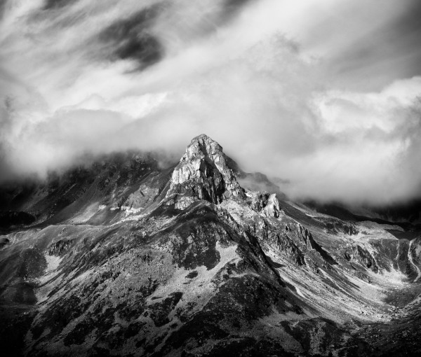
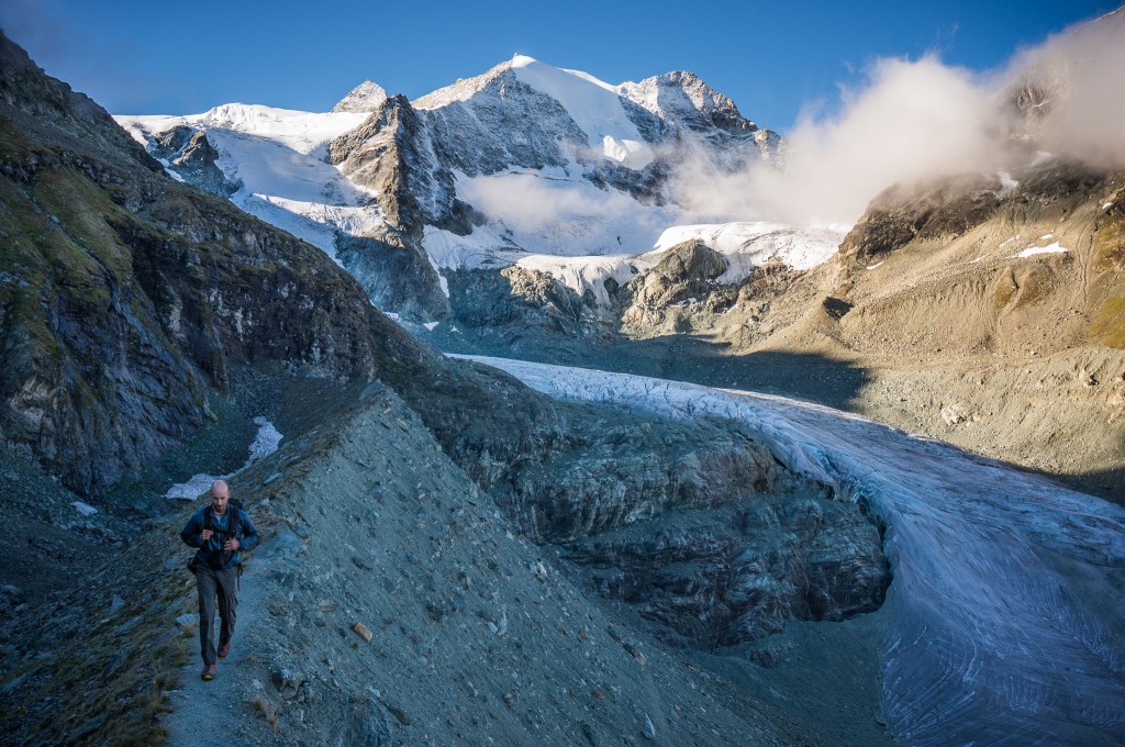
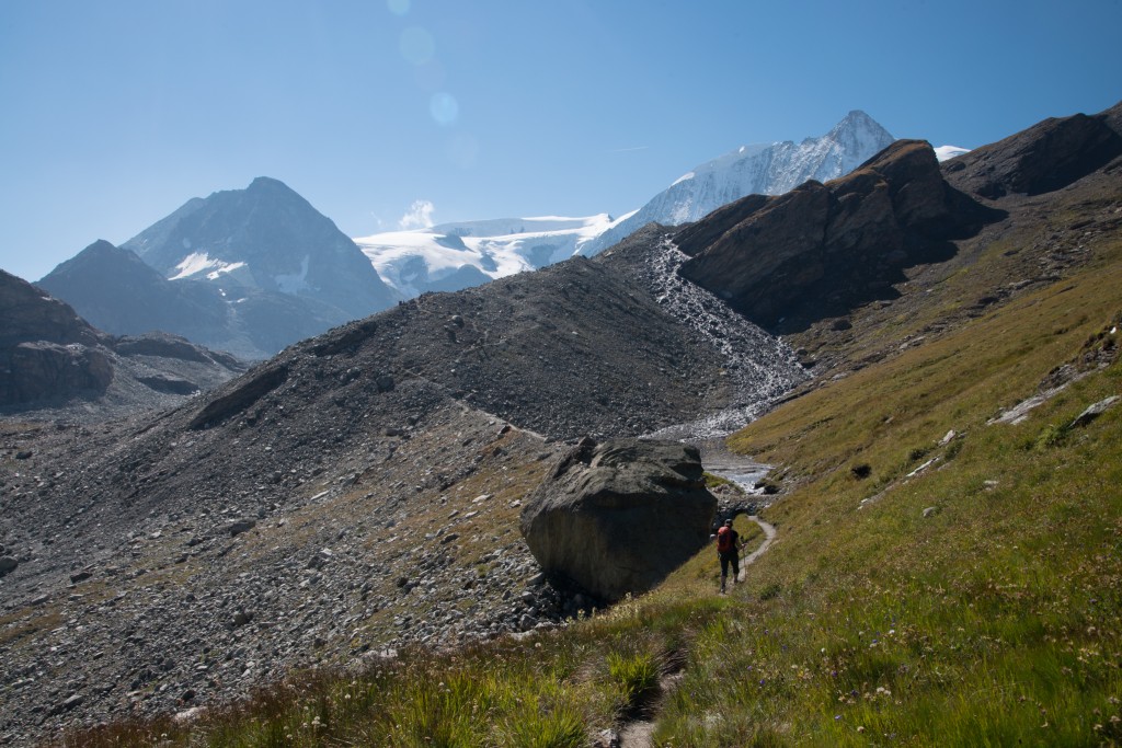
Day eleven marked the last true day of “tough” hiking with a route that lead over the Augstbordpass and into the Mattertal valley to St. Niklaus. We woke early, grabbed a filling breakfast, and headed out into the cool and overcast morning. For the previous couple days, the weather had been starting to turn more seasonal, both cooling and becoming more overcast.
The hike itself goes virtually straight up towards the col, heading steeply up the side of the valley before following a smaller valley up to the Augstbordpass. As we climbed, the views back over the valley opened up and we heard the characteristic clang of cow bells as herders brought back in their cattle for the season.
At one point, a young man passed with a small herd of cattle following. Anne and I stepped off the path to allow the caravan to pass and were viewed inquisitively by the passing bovine.
As we headed up the valley, the wind picked up and the temperature seemed to drop.
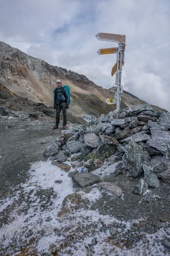
The final climb to the pass was bitterly cold with rhyme ice covering the plants, rocks, and sign posts. We stopped quickly for the obligatory pass photo before dropping down into the Mattertal in search of a respite from the biting wind and cold.
This path descends directly down a small side valley before cutting sharply right and traversing along the valley side along a mostly scree slope that is sometimes exposed. The slight amount of gain is rewarded handsomely at the Twära overlook.
The path from the overlook led relatively directly and steeply to the small town of Jungen. While it was possible to see Jungen a short while after passing the Twära overlook, it took considerably longer than expected to actually reach to the town. Here we ran into Rich, Denise, and Brian eating at the Junger Stübli where we sat down to rest and enjoy with them for a short while. Take note, there is a room for let in the Stübli and if you have the time you should certainly try for it since it would afford excellent views in one of the most beautiful small Swiss Alp villages I’ve ever seen.
The rest of the path to St. Niklaus was relatively straight forward and took about an hour to complete with our sore legs and tired backs. Arriving in St. Niklaus, it’s a little easy to get overwhelmed with the size and complexity of the town having just spent over a week in very small villages. We had to ask directions to make it to our hotel at the south end of town but we arrived soon enough and settled into our room, happy to be one day away from our final objective of Zermatt.
Total distance: 13.12 mi
Max elevation: 9485 ft
Min elevation: 3665 ft
Max elevation: 9485 ft
Min elevation: 3665 ft
Feb
09
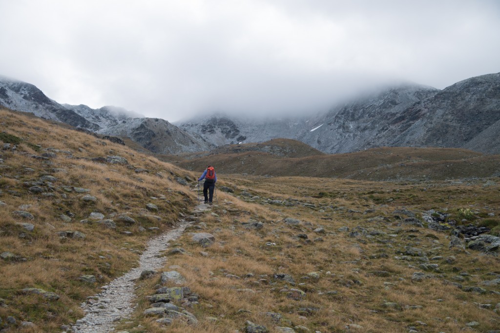
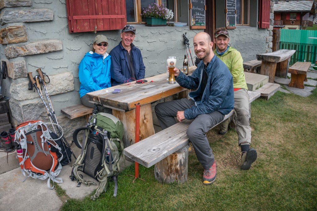
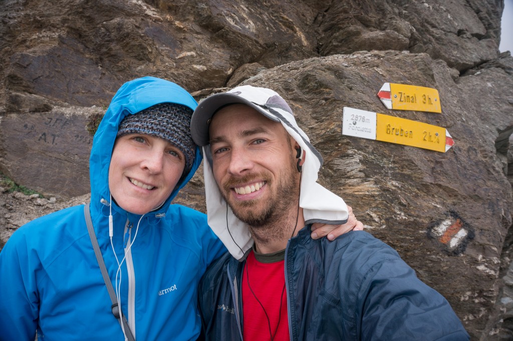
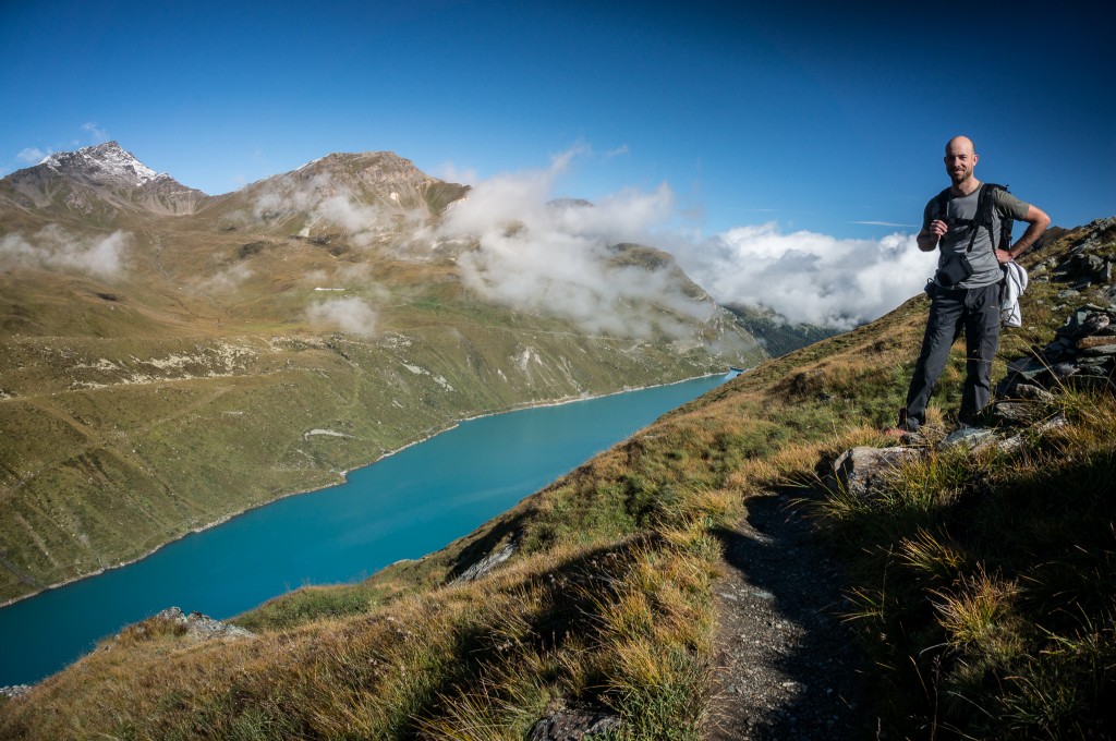
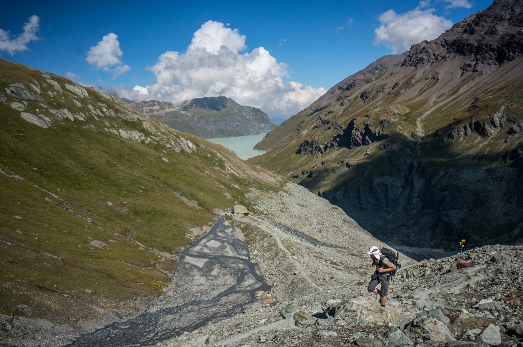
2014As mentioned previously, from Zinal there are a couple options for hikers on the way to Gruben. Our path led us over the Forcletta directly to Gruben. However, it’s also possible to take a detour towards the Hotel Weisshorn and then pass towards Gruben via the Meidpass. This second option allows trekkers to inject a stay at the Hotel Weisshorn, which is recommended in the guidebook if you have the time to spare. This can also be accomplished as day hike to Gruben by adding on distance and a little more elevation gain.
Because Anne and I were on a tighter schedule than we’d first thought, we needed to head directly to Gruben in order to have a full day to enjoy Zermatt. This led us up towards the Forcletta. The path out of town was a little hard to find and the directions in the guidebook didn’t map well to the surroundings. We headed up past the church and then broke left on a road that led to some construction and finally between the large apartment blocks indicated in the book description. This then led uphill out of town, steadily gaining elevation and traversing along the valley side with intermittent views.
The trail here is well graded, almost flat in fact, and is some of the best trail along the entire route. Here the trail winds into one small side valley at Barneuza before coming back and continuing its traverse down the valley. Before long, a second deeper side valley causes the trail to turn right. At the head of this valley the trail splits, a steep trail cutting right leads to the Forcletta while the well graded path continues along a climbing traverse towards Hotel Weisshorn.
Anne and I headed right and started the steep ascent towards the col. This trail was obviously new, created by some crazed Swiss farmer who drives heavy machinery directly uphill rather than forming more logical and well graded switchback. Here the trail climbs steeply towards a small house and barn where it again levels out, crosses a pasture, and then again climbs steeply towards the col.
By this time, the pleasant morning weather had given way to clouds, wind, and generally cold temperatures that caused Anne and me to bundle up more than we had in all previous days of hiking. It also meant that the stupendous views discussed in the book were obscured in clouds, a bummer to be sure. We stopped quickly at the pass to take some photos before quickly heading down the other side in search of a respite from the stinging wind and cold.
The trail from the Forcletta drops quickly into a nice alpine meadow. Were the temperatures and light more favorable, this would have been a wonderful place for photography with some small stone pathways, bridges, and serpentine streams flowing.
Before long, we came to a complex of buildings called Chalte Berg where the path becomes faint and hard to follow. Anne and I followed a faint track along a level traverse to the left of the Chalte Berg, which we soon found to be a wrong turn. The correct path leads down the valley just to the left of the road. Hikers can also follow the road since the path eventually joins and then crosses it to head into the valley to Gruben.
The trail cuts the road switchbacks for a little while before heading into the woods and then descending moderately through forest and finally to the valley floor. The trail pops out right into the driveway of a farm and then heads to the stream before turning left and following pasture the rest of the way into town. We made the mistake of trying to follow the trail around the pasture rather than jumping the fence, a choice that seemed logical until we go to the other side of the pasture and were forced to jump over fences.
Gruben is the first town along the path where German is the spoken language rather than French. It’s a little hard to conceive that one valley could be culturally so different from the next. A simple walk of 7 hours and 10 miles makes all the difference in the world! The small town of Gruben is also a wonderfully beautiful town with some old architecture and cute buildings. Alas, Anne and I were both so tired from the day and the weather was threatening such that we didn’t wander and take many photos.
We stayed at the Hotel Schwartzhorn, which is really the only accommodation in town. It was virtually filled and Anne and I were placed in the dorm with a couple of our new friends and a host of others travelling along the way. We made a last minute move to change rooms when one of our dorm mates started snoring, a great reminder that when sleeping in dorm rooms it pays to both bring ear plugs and to try and get dorm rooms with people you know and trust. Thankfully, we slept soundly that night and woke the next morning well rested and charged for our next big day.
Total distance: 10.9 mi
Max elevation: 9413 ft
Min elevation: 5502 ft
Max elevation: 9413 ft
Min elevation: 5502 ft
Jan
11
2014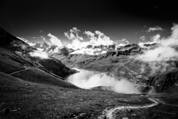
Stage 9 traverses back down the Val de Moiry to the foot of the lake before climbing to a pass and descending into Zinal. We got our standard early start and descended back down the switchbacks to the trail leading along the moraine. Along the way we were lucky to spot more ibex walking along the hillside above us.
The path towards Zinal splits before reaching the parking lot, instead taking a high traverse along the valley and above the lake. Unlike the previous day, the forecast was good and the sun was out with blue patches of sky all around. However, some precipitation had fallen the night before dusting the upper slopes with frost and traces of snow.
(photo by Anne Archambault)
We traversed along the trail, taking in the incredible views down the valley towards the dam and the even more incredible views back up the valley to the glacier, hut, and mountain peaks. Below us the glacial lake was a brilliant turquoise in color. Above, the careful eye could make out both ibex and chamois moving about the rocks.
(photo by Anne Archambault)
The trail traverses to just above the dam at the end of Lac de Moiry before climbing, slowly switch backing along a road at first and then much more directly, up to the Col de Sorebois. As we reached the col, we found that while our side of the pass was very much in sunlight, the other side of the pass was completely obscured in fog. Rather than breaking for lunch, we decided to head down and hope for better weather lower down.
It wasn’t long before breaks in the clouds rewarded us with some pretty incredible views of the mountains waiting for us on the other side of the valley. As Anne pointed out the small break in the clouds, I gasped with amazement at the jagged peaks emerging from the whiteout.
The descent from the pass was relatively non-descript. We hiked along a path that at times was a two track road servicing the ski area and others a small trail that cut between switchbacks in the road. Ski lifts crisscrossed above making the place feel more urban than most of what we’d experienced along the way. We descended to the Sorebois cable car station where we grabbed some seats on the deserted terrace and had lunch overlooking the valley below us.
(photo by Anne Archambault)
The rest of the path down was a grunt. The trail switchbacks in open meadows at a relatively aggressive grade before entering trees and heading almost straight down the mountain. There are few trails I’ve been on that have been so tiring on the descent and I was very glad to have my poles to steady my walk and help preserve my knees. After what felt like hours the trail finally leveled out near the base of the valley and traversed above the river to a bridge where we finally crossed into town.
(photo by Anne Archambault)
Zinal is a sizable village with an ATM, restaurants, a couple grocery stores, and a collection of outdoor and gear shops. The hotels here were reasonably priced and provided bus passes for transit up and down the valley should the need arise. Anne and I were happy to have a little extra time during the day to wash clothes, enjoy the warmth of the sun, and relax.
Since we weren’t sure who among our party was going directly to Gruben versus Hotel Weisshorn, we organized dinner at the Hotel Europa where all of our travelling friends got a table together and enjoyed what we hoped would not be our last evening together as a group.
Total distance: 10.67 mi
Max elevation: 9328 ft
Min elevation: 5446 ft
Max elevation: 9328 ft
Min elevation: 5446 ft
Jan
04
2014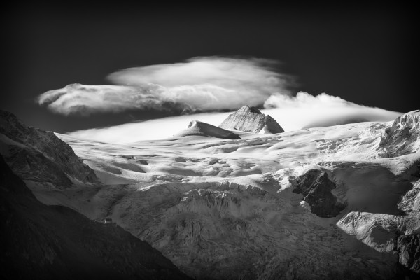
The hike from La Sage to Cabane de Moiry counts as probably the second hardest day of the trip behind the long and tiring traverse from Cabane du Mont Fort to Cabane de Prafleuri. On paper, this stage of the trip shares the title for largest elevation gain and the hike lived up to that hype. To make matters more intimidating, the weather forecast called for 90% chance of rain.
Because of the big day ahead of us, Anne and I got started as early as we could, taking first call at breakfast and shoving off before 8am. We’d both taken the hint from the weather forecast and started with rain pants and pack covers on. I was glad my rain pants had full length zips because it wasn’t long before I was getting warm and looking to dump excess heat as we climbed steeply up the valley walls towards the Col du Tsaté.
(photo by Anne Archambault)
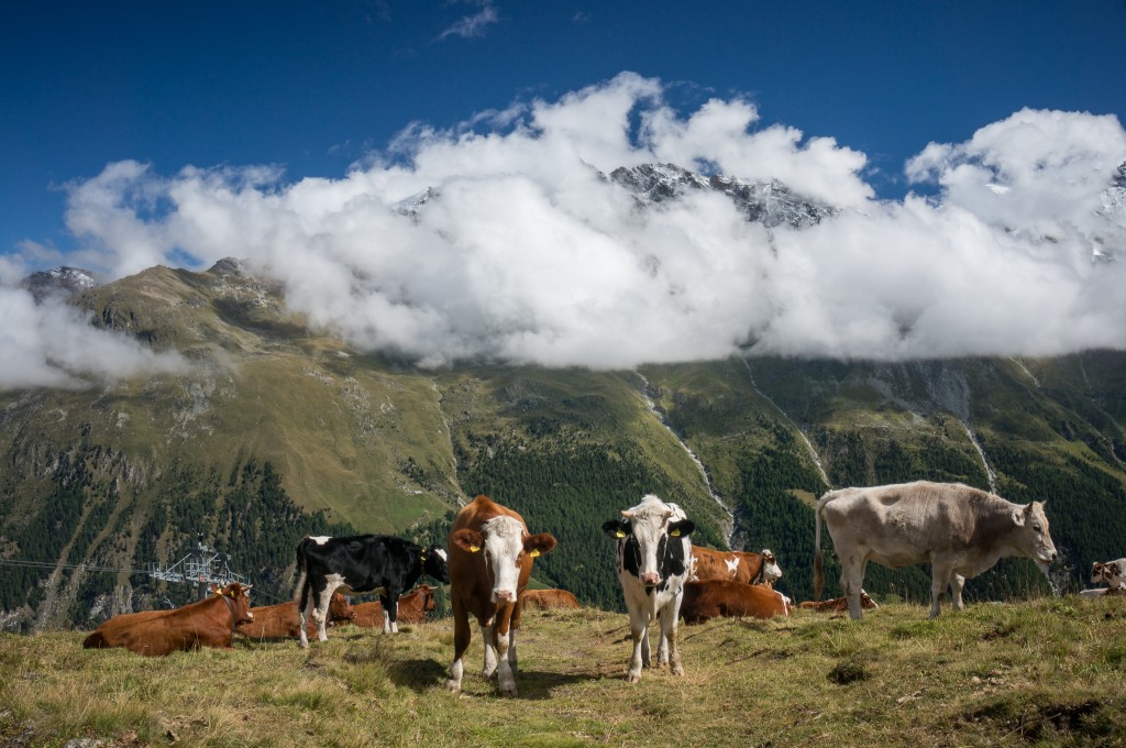
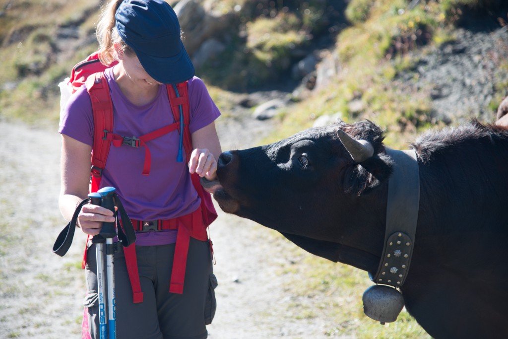
It’s worth noting that most of the trail from Chamonix to Zermatt passes through summer pasture land. However, nowhere on the Haute Route was the evidence of cows more present than in the climb from La Sage up to Col du Tsaté. In places, it was almost impossible to walk without stepping in cow pies. This got us into the habit of identifying such parcels on the trail and calling out “Caca Suisse!” to avoid stepping in them.
The descent from the col led to a pronounced flank along the valley, likely an old moraine, from which there was a steep descent to the lake and, um, parking lot. That’s right, you can take a bus here and in the summer there’s even a refreshment stand. Anne and I grabbed a bench and made lunch while we looked at other tourists who’d driven up to the parking lot for a picnic. It wasn’t long before Val, Kathy, Eliza, and Gareth joined us and we had a great lunch before heading off and up again to the hut.
(photo by Anne Archambault)
The final part of the day involved a hike up from the parking lot to gain the crest of the lateral moraine running up the valley. This then descends off the moraine and over to the valley wall where it again climbs steeply in switchbacks until it finally gains a stupendous overlook and the Cabane de Moiry. Alas, most of our hike was in low clouds obscuring the view up the mountain and threatening rain. Combined with the already large dose of elevation gain, it turned the final part of the hike into a chore.
(photo by Anne Archambault)
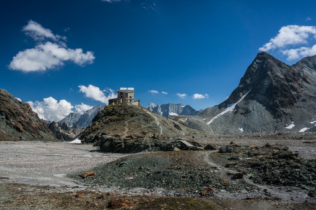
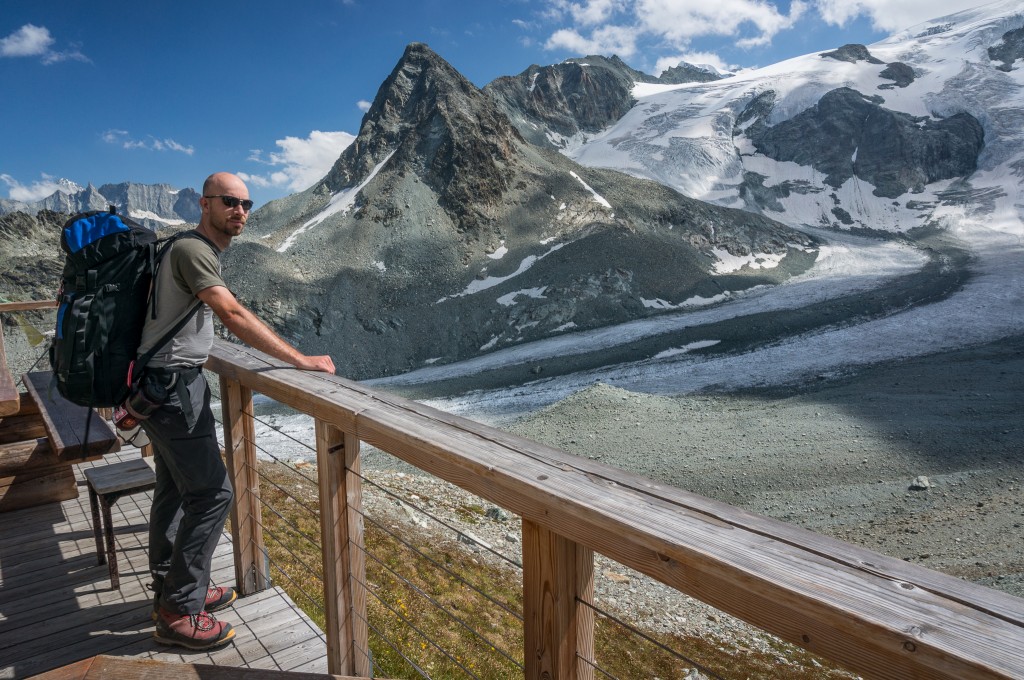
Without a doubt, Cabane de Moiry was the highlight of the trip for me. The hut sits atop an incredible viewpoint and has windows that stretch floor to ceiling and provide unmatched views across the glacier to the mountains towering over them.
From the hut it’s possible to access a myriad of rock climbs as well as glacier travel, advanced mountaineering, and ski touring in the winter. Our entire entourage was happy to sit back, read, drink beer, and enjoy this wonderful setting. As a bonus, we were even able to see ibex while we were eating. Truly a glorious setting and a highlight of the trip!
(photo by Anne Archambault)
Total distance: 8.12 mi
Max elevation: 9401 ft
Min elevation: 5405 ft
Max elevation: 9401 ft
Min elevation: 5405 ft
Jan
01
2014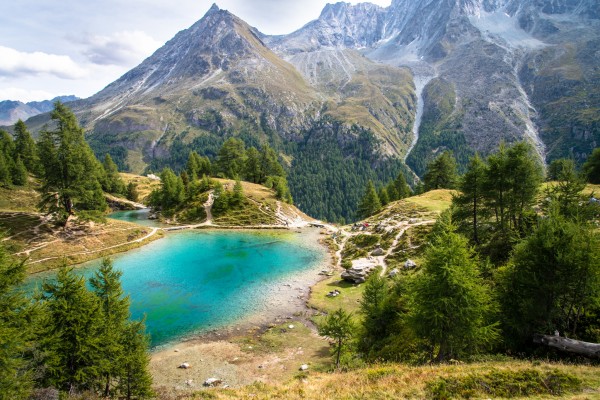
The stage from Arolla to La Sage is probably the most poorly described stage in the guide book. While this stage reads like a “rest stage” as you walk down the valley from Arolla to Les Haudères with 215m of elevation gain covered in 4 hours, we in fact gained about 2000 feet of elevation as we climbed out of Arolla and traversed above the valley floor to Lac Bleu in a total of 6 hours. Anything but the day we had been expecting!
(photo by Anne Archambault)
To make the day more exciting, Anne and I chose the “harder” of the two paths to Lac Bleu leaving from Arolla and climbing steeply away from the village and above the valley below. As described in the guidebook, this trail had several sections with chains that we hoped would lead to some exposed sections with grand views. However, it was largely a letdown as most chain-protected sections were really quite safe hiking except perhaps in freezing conditions.
(photo by Anne Archambault)
Elevation was gained steeply out of Arolla, which then turned into a traverse along the valley. This traverse steeply gained and lost elevation constantly until we reached Lac Bleu, the final high point on the path before descending to Les Haudères. Lac Bleu is the highlight of the stage with an incredible vista over the valley combined with a surreal blue hue. We took time to eat lunch and dip our feet in the cold lake.
Leaving Lac Bleu you immediately come to some old buildings where we should have turned right and headed steeply down towards La Gouille. Instead, we continued along our traverse following signs towards Evolène. We soon realized that the trail we were on continued down the valley but in the wrong direction and away from Les Haudères. The mistake was easily corrected; we joined a trail leading back to La Gouille and turned back around, only losing about 15 minutes time on the detour.
(photo by Anne Archambault)
From La Gouille, the trail dips below the road and towards the creek on the east side of the valley, falling rather steeply down to Les Haudères on a generally shaded two track road. In Les Haudères, we grabbed lunch, rested, and restocked our supplies for the next couple days.
I’ll make a call out for the local Les Haudères tomme cheese. Hikers should note that most of the villages along the way make town or valley specific cheeses. The tomme in Les Haudères was probably the finest of the trip. If you do pass through town, don’t miss out on this fantastic cheese!
Supplied up, we joined back with the trail to La Sage which climbs out of Les Haudères and gains 200 or so meters of elevation quickly to La Sage. Here Anne and I came across a pair of farmers with a small boy. They’d apparently been gathering fire wood when they managed to turn their tractor over on the path. I dropped my pack and tried to help them get the vehicle upright. Gareth, Val, and Kathy soon joined us and despite having the additional horsepower, we were completely unable to get the tractor right side up. Despite our lack of success, the farmers were grateful for the help and thanked us as we put our packs back on and headed the last short bit to the hotel.
(photo by Anne Archambault)
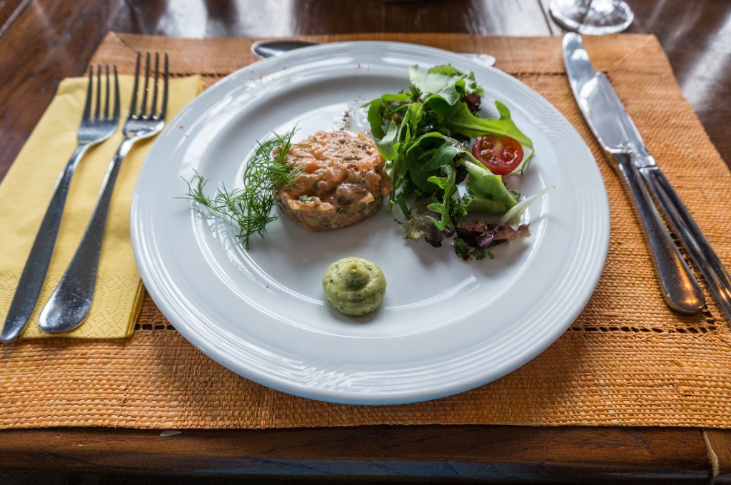
The Hotel De La Sage is one of two places you can stay in La Sage. We’d booked our rooms the previous night at dinner in Arolla and were lucky enough to secure rooms for everyone in our party. In terms of hotels, Hotel De La Sage easily takes the prize for being the nicest hotel we stayed at during our entire visit. Inside the rooms had been recently renovated and were very modern both in conveniences like outlets as well as in style.
(photo by Anne Archambault)
The included dinner looked like something out of a foodie gastropub. We had salmon tartar as an appetizer, duck breast as a main course, and we finished with an outstanding cheesecake.
(photo by Anne Archambault)
Total distance: 9.32 mi
Max elevation: 6998 ft
Min elevation: 4639 ft
Max elevation: 6998 ft
Min elevation: 4639 ft
Dec
30
2013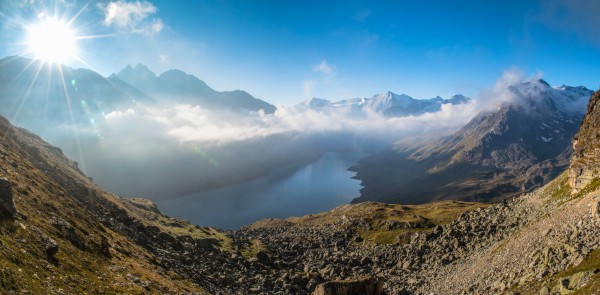
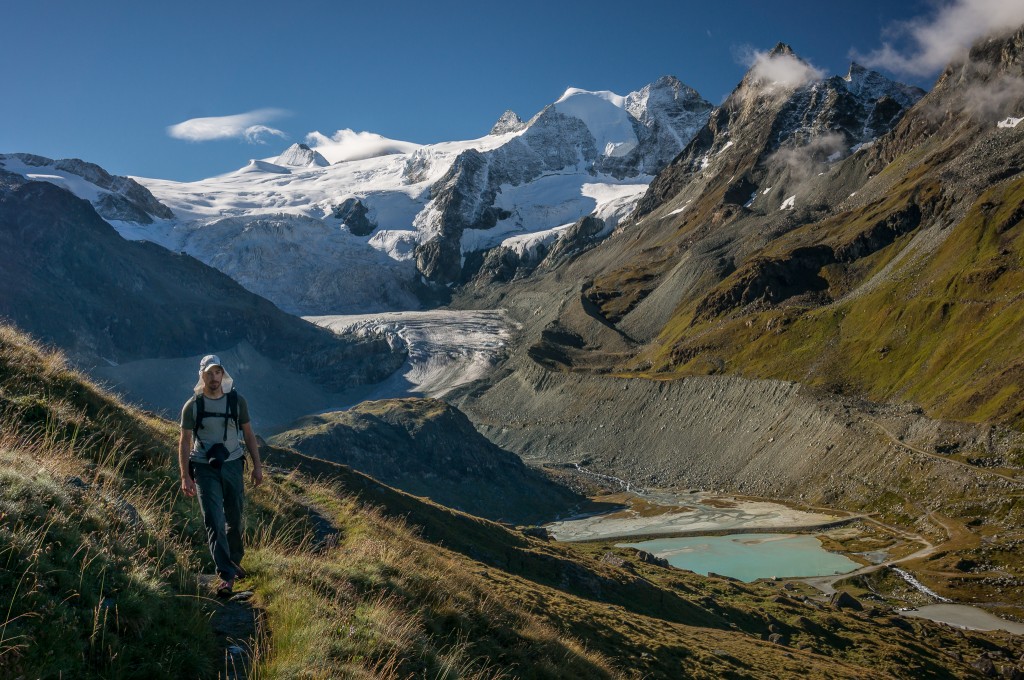
The stage from Cabane de Prafleuri to Arolla is arguably the most beautiful stage of the entire walk from Chamonix to Zermatt. The day starts with a short climb up to the Col des Roux which opens into beautiful views over Lac des Dix and up the valley towards Mont Blanc de Cheilon. The morning light over the valley was incredible and Anne and I quickly fell behind the other groups as we took pictures.
The trail worked its way gradually down to about 100 feet or so above the level of the lake where we met up with the rest of our traveling buddies and traversed along a road to the lake’s south end. Marmot dotted rocks along the hillside, sunning themselves in the morning light. This area is also open pasture so we shared the path with a fair number of friendly cattle.
At the south end of the lake the trail climbs steeply away from the lake and up a valley that quickly turns into a glacial moraine. The remains of the old Cabane des Dix are passed some 15 minutes after leaving the road, which serve as a testament to how long mountain huts have been a part of the culture as well as a reminder of a time when the glaciers were larger and more prominent.
From the old hut, the path climbs steadily until it reaches a junction where the path forks. On the left the path leads directly to the col and on the right the path continues to climb up the moraine towards Cabane des Dix. We continued right in search of grand views up the valley over Mont Blanc de Cheilon and a peaceful lunch on the hut’s patio.
(photo by Anne Archambault)
Continuing up and along the moraine, views over the glacier opened up and we could easily see the other path crossing below the glacial snout, the path over the col, and the notch indicating the upcoming ladders at the Pas de Chèvres.
(photo by Anne Archambault)
I found the last section of the hike to Cabane des Dix to be deceiving because it involved a lot more climbing than I’d imagined. From the moraine, the path drops right across a small ravine and then climbs steadily around a blind corner that reveals another 200 feet or so of elevation gain to a ridge that marks the high point for the day. Upon gaining the ridge we got our first glimpse of Cabane des Dix as well as excellent views over Mont Blanc de Cheilon and associated glacier. Here I stopped to take a panorama while Anne continued on towards the hut and a well-deserved lunch.
After lunch our path took us down and across the glacier to the other side of the valley. Normally glacier crossings are only to be done with rope and proper equipment. However, this particular crossing is across firm ice and lacks the crevasses and snow bridges that typically mark dangerous conditions. A route is well established across the glacier and is marked by cairns and a decent foot path.
(photo by Anne Archambault)
After climbing a short distance up the moraine and away from the glacier, the trail traversed several hundred meters of scree to rejoin the original trail leading to the Col de Reidmatten. This in turn climbed another 150 feet or so before splitting off yet again and traversing over to the ladders at the Pas de Chèvres.
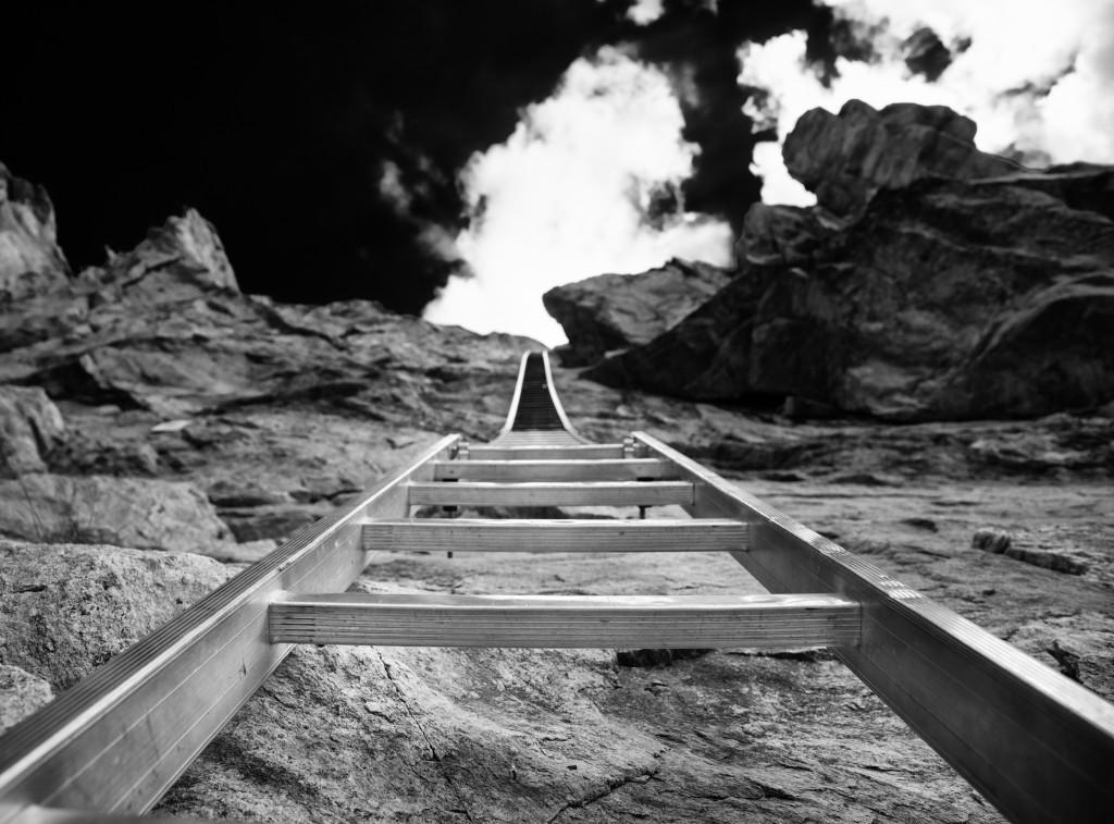
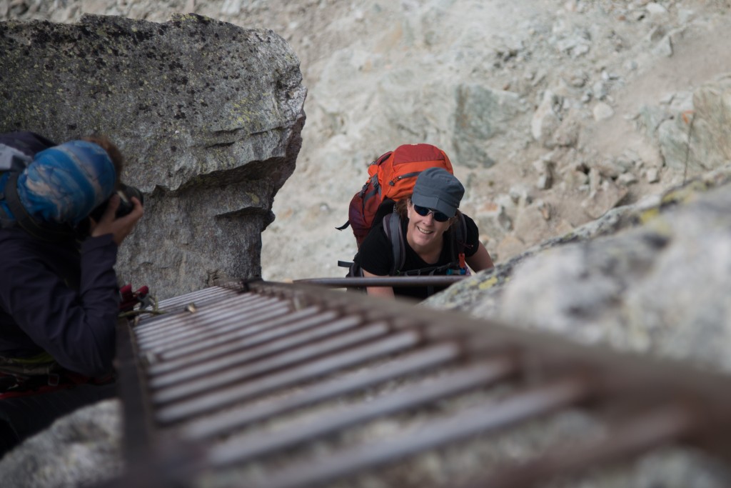
For Anne and myself, the ladders at the Pas de Chèvres were probably the highlight of the hike. The ladders climb almost vertically for about 30 feet, sidestep 4 feet, and then continue about another 15 feet before topping out at the pass. The climb up the ladders was surprisingly tiring, not helped by the fact that each of us was carrying a loaded pack.
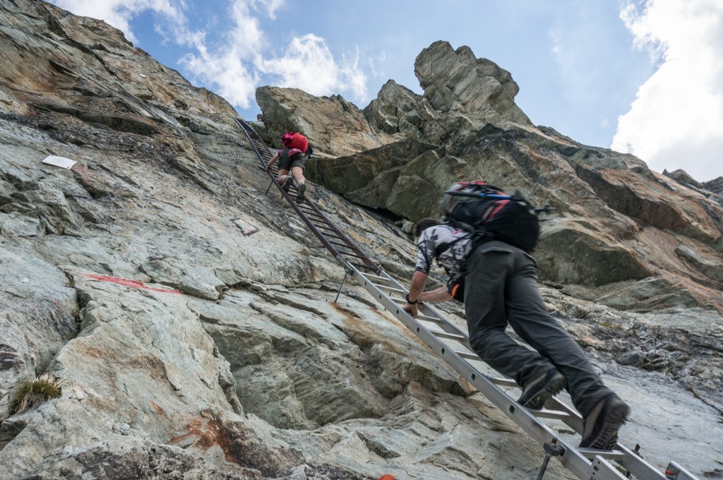
(photo by Anne Archambault)
Rich, who had some climbing gear, was nice enough to climb up and tie himself in so he could take photos as we climbed.
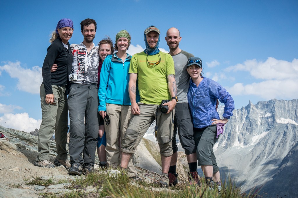
Each of us, in turn, climbed up to the top with resultant cheers and high fives as we topped out and looked out over the glacier below. Once all at the top, we gathered for a group portrait while taking a short break and celebrating the final uphill portion of the day before the long downhill hike to Arolla.
The hike down to Arolla was generally well graded and traversed across open alpine terrain and ski slopes before heading down a steep set of switchbacks into the trees and finally into Arolla itself.
Since we didn’t have advance reservations, we stopped by the tourist office and inquired about hotels, pricing and availability. We settled on the Hotel de Mont Collon after the woman at the tourism office remarked about how nice and “romantic” the hotel was with all the “tapestries” it had. On hindsight, we might have been better served with another hotel since the Hotel de Mont Collon was more worn down than romantic and the rooms had a tired feel to them. The hotel was also located below town and hence below the next day’s trail head, which required us to hike back uphill to start our day.
(photo by Anne Archambault)
For dinner, we all decided to head back up into the heart of town where there were some limited dining options. We settled on a restaurant that had raclette on the menu, which was something that Anne and I had been excitedly waiting to eat. Raclette is a traditional Swiss dish that involves placing a wheel of raclette style cheese near a heating source, scraping that cheese off onto a plate, and then service with cooked potatoes and pickled pearl onions, gherkins, and sometimes meat slices.
We enthusiastically got some of our friends to try this cheese dish, which in this case was served by the hostess who would ferry plates back and forth to the heated cheese and with bread, potatoes, gherkins, and pickled pearl onions. The meal was exceptionally filling and I certainly went to bed knowing I wouldn’t be wanting for calories on the following day!
Note: While Arolla may seem like a large town from descriptions in the guide book, it does not have an ATM machine. You can withdraw money at the Tourism Office, but they will charge you an additional fee for the service. In fact, the next closest ATM machine is in Evolène down the valley several hours by foot and a detour from the path.
Total distance: 14.79 mi
Max elevation: 9762 ft
Min elevation: 6493 ft
Max elevation: 9762 ft
Min elevation: 6493 ft