30
2013The Haute Route Day 6 – Cabane de Prafleuri to Arolla
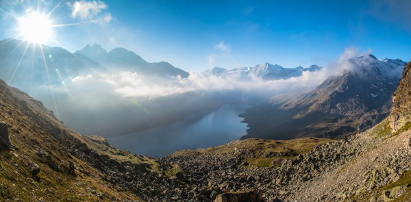
The stage from Cabane de Prafleuri to Arolla is arguably the most beautiful stage of the entire walk from Chamonix to Zermatt. The day starts with a short climb up to the Col des Roux which opens into beautiful views over Lac des Dix and up the valley towards Mont Blanc de Cheilon. The morning light over the valley was incredible and Anne and I quickly fell behind the other groups as we took pictures.
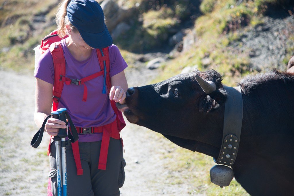
The trail worked its way gradually down to about 100 feet or so above the level of the lake where we met up with the rest of our traveling buddies and traversed along a road to the lake’s south end. Marmot dotted rocks along the hillside, sunning themselves in the morning light. This area is also open pasture so we shared the path with a fair number of friendly cattle.
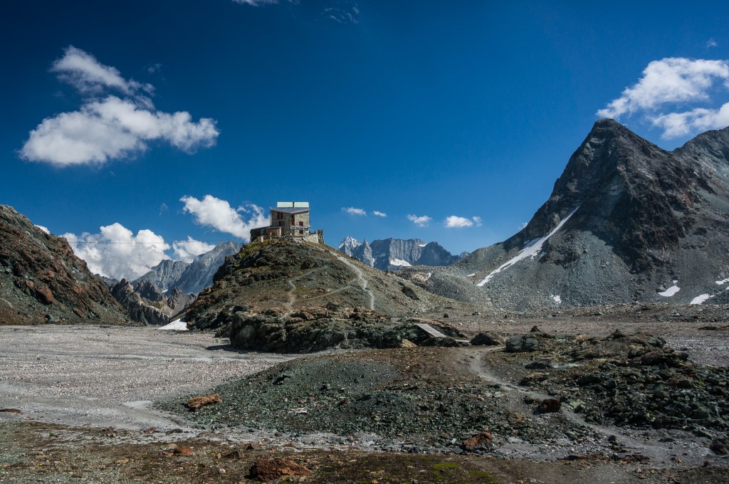
At the south end of the lake the trail climbs steeply away from the lake and up a valley that quickly turns into a glacial moraine. The remains of the old Cabane des Dix are passed some 15 minutes after leaving the road, which serve as a testament to how long mountain huts have been a part of the culture as well as a reminder of a time when the glaciers were larger and more prominent.
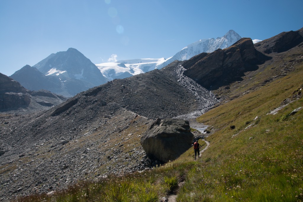
From the old hut, the path climbs steadily until it reaches a junction where the path forks. On the left the path leads directly to the col and on the right the path continues to climb up the moraine towards Cabane des Dix. We continued right in search of grand views up the valley over Mont Blanc de Cheilon and a peaceful lunch on the hut’s patio.
(photo by Anne Archambault)
Continuing up and along the moraine, views over the glacier opened up and we could easily see the other path crossing below the glacial snout, the path over the col, and the notch indicating the upcoming ladders at the Pas de Chèvres.
(photo by Anne Archambault)
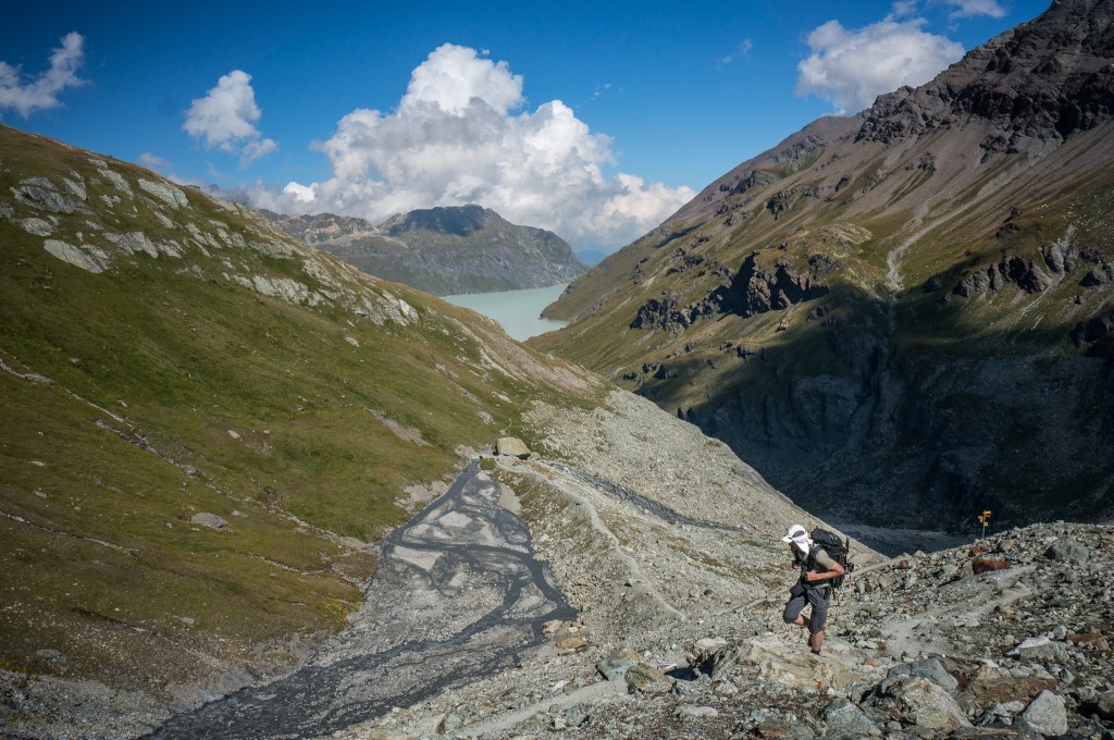
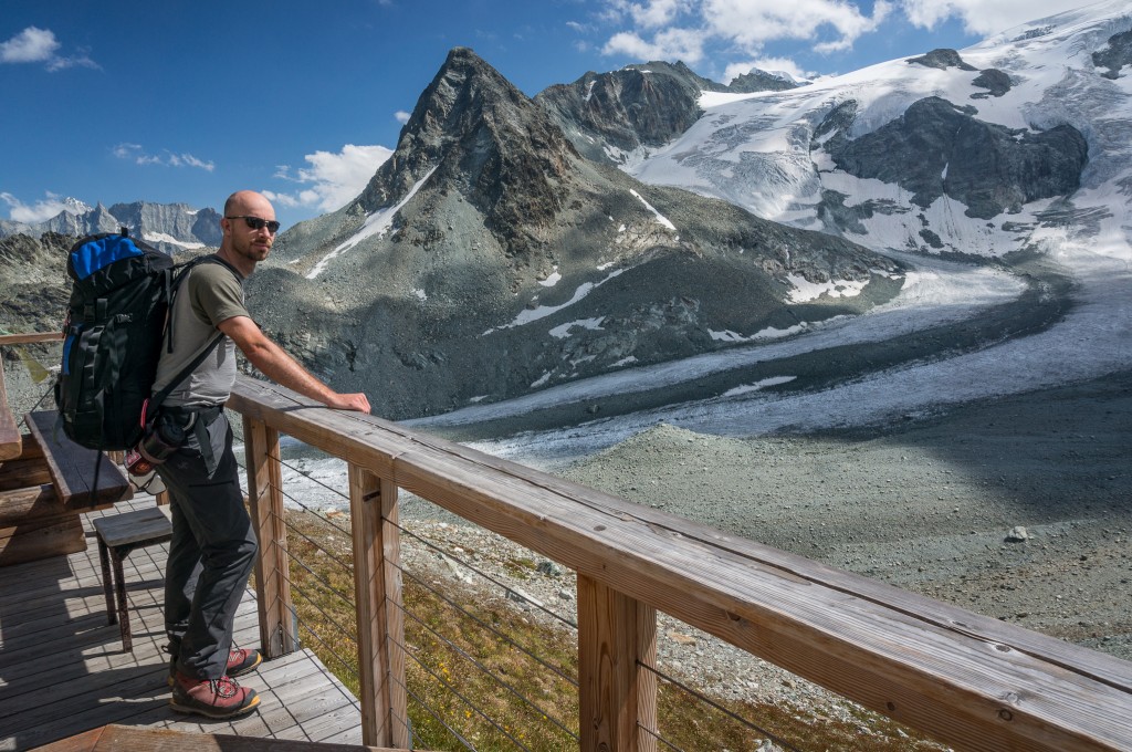
I found the last section of the hike to Cabane des Dix to be deceiving because it involved a lot more climbing than I’d imagined. From the moraine, the path drops right across a small ravine and then climbs steadily around a blind corner that reveals another 200 feet or so of elevation gain to a ridge that marks the high point for the day. Upon gaining the ridge we got our first glimpse of Cabane des Dix as well as excellent views over Mont Blanc de Cheilon and associated glacier. Here I stopped to take a panorama while Anne continued on towards the hut and a well-deserved lunch.
After lunch our path took us down and across the glacier to the other side of the valley. Normally glacier crossings are only to be done with rope and proper equipment. However, this particular crossing is across firm ice and lacks the crevasses and snow bridges that typically mark dangerous conditions. A route is well established across the glacier and is marked by cairns and a decent foot path.
(photo by Anne Archambault)
After climbing a short distance up the moraine and away from the glacier, the trail traversed several hundred meters of scree to rejoin the original trail leading to the Col de Reidmatten. This in turn climbed another 150 feet or so before splitting off yet again and traversing over to the ladders at the Pas de Chèvres.
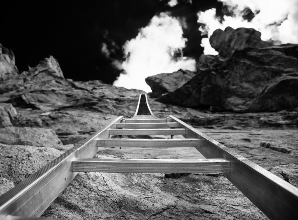
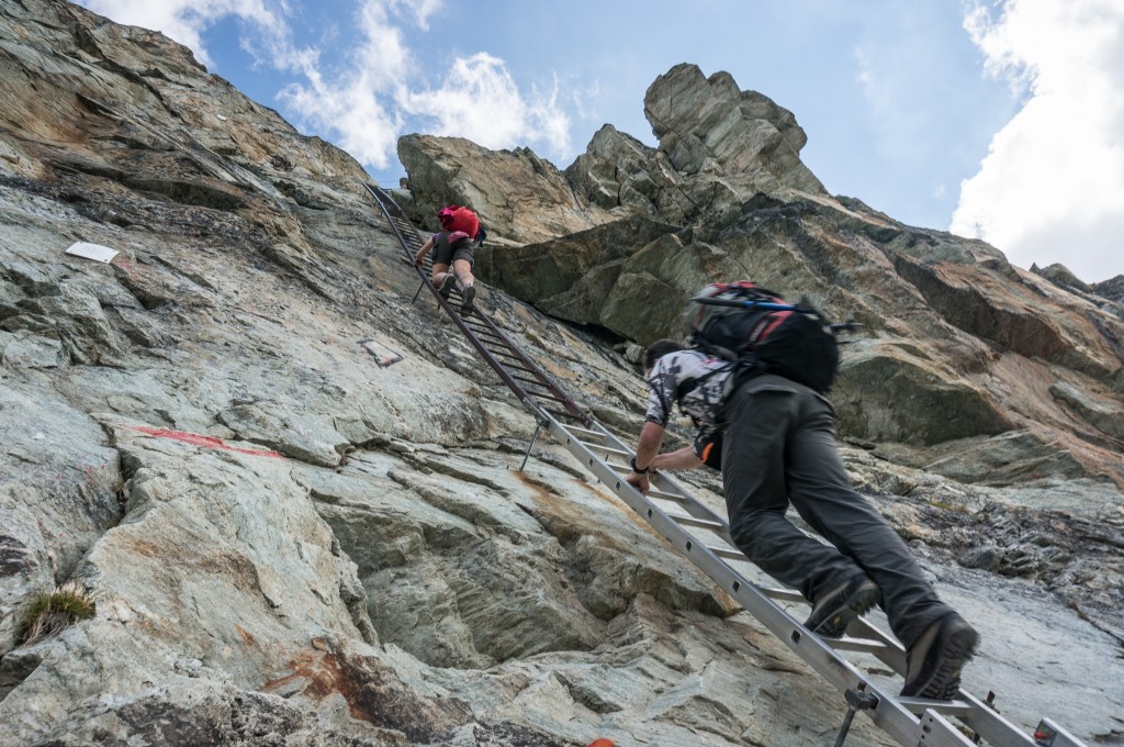
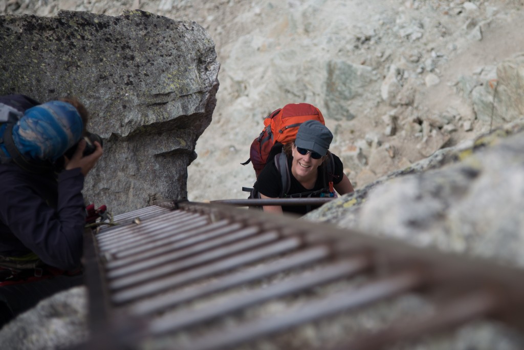
For Anne and myself, the ladders at the Pas de Chèvres were probably the highlight of the hike. The ladders climb almost vertically for about 30 feet, sidestep 4 feet, and then continue about another 15 feet before topping out at the pass. The climb up the ladders was surprisingly tiring, not helped by the fact that each of us was carrying a loaded pack.
(photo by Anne Archambault)
Rich, who had some climbing gear, was nice enough to climb up and tie himself in so he could take photos as we climbed.
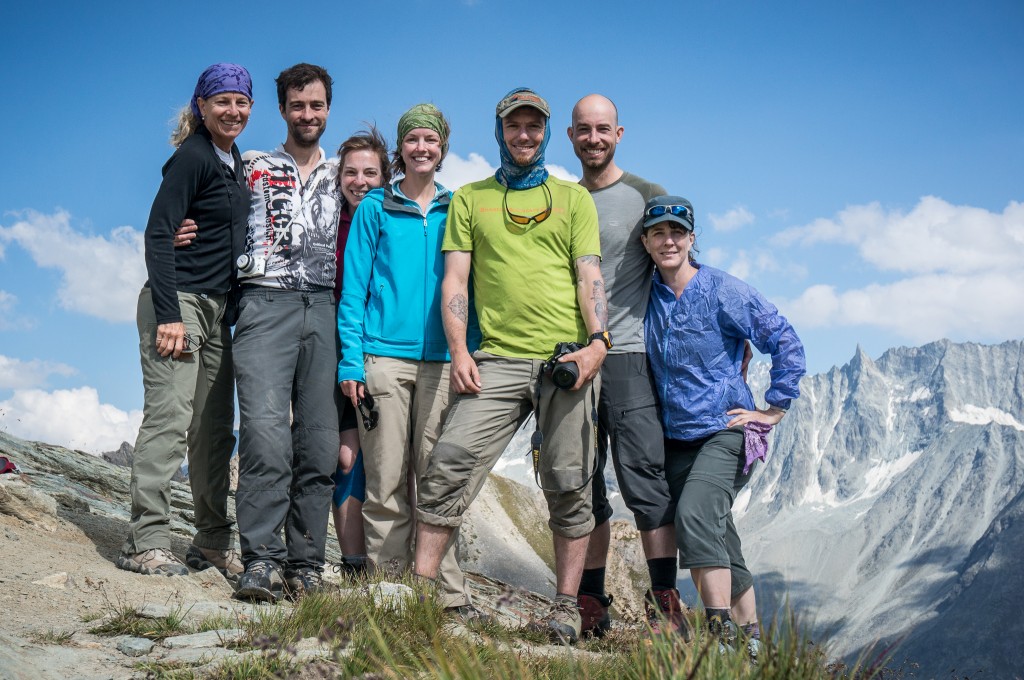
Each of us, in turn, climbed up to the top with resultant cheers and high fives as we topped out and looked out over the glacier below. Once all at the top, we gathered for a group portrait while taking a short break and celebrating the final uphill portion of the day before the long downhill hike to Arolla.
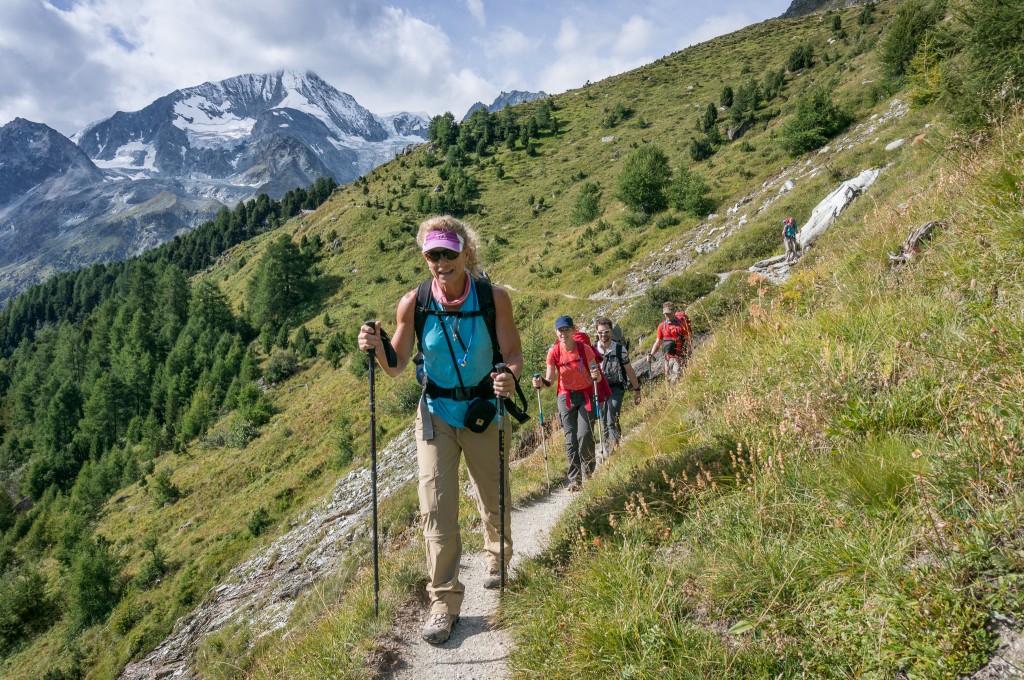
The hike down to Arolla was generally well graded and traversed across open alpine terrain and ski slopes before heading down a steep set of switchbacks into the trees and finally into Arolla itself.
Since we didn’t have advance reservations, we stopped by the tourist office and inquired about hotels, pricing and availability. We settled on the Hotel de Mont Collon after the woman at the tourism office remarked about how nice and “romantic” the hotel was with all the “tapestries” it had. On hindsight, we might have been better served with another hotel since the Hotel de Mont Collon was more worn down than romantic and the rooms had a tired feel to them. The hotel was also located below town and hence below the next day’s trail head, which required us to hike back uphill to start our day.
(photo by Anne Archambault)
For dinner, we all decided to head back up into the heart of town where there were some limited dining options. We settled on a restaurant that had raclette on the menu, which was something that Anne and I had been excitedly waiting to eat. Raclette is a traditional Swiss dish that involves placing a wheel of raclette style cheese near a heating source, scraping that cheese off onto a plate, and then service with cooked potatoes and pickled pearl onions, gherkins, and sometimes meat slices.
We enthusiastically got some of our friends to try this cheese dish, which in this case was served by the hostess who would ferry plates back and forth to the heated cheese and with bread, potatoes, gherkins, and pickled pearl onions. The meal was exceptionally filling and I certainly went to bed knowing I wouldn’t be wanting for calories on the following day!
Note: While Arolla may seem like a large town from descriptions in the guide book, it does not have an ATM machine. You can withdraw money at the Tourism Office, but they will charge you an additional fee for the service. In fact, the next closest ATM machine is in Evolène down the valley several hours by foot and a detour from the path.
Max elevation: 9762 ft
Min elevation: 6493 ft