17
2014Mt. Curtis Gilbert – Goat Rocks Wilderness
Mt. Curtis Gilbert (8184 ft) in the Goat Rocks Wilderness has been on Anne’s and my climb list for a while. Given that we hadn’t been on an overnight backpacking trip since our Zion Narrows trip and that the forecast looked promising, we decided to give it a go. Peggy Goldman’s Washington Scrambles book listed the hike’s coordinates as relatively moderate with an 8 mile/2000ft approach to Warm Lake and another 4 miles/2000ft to gain the summit. We loaded up our packs Friday night and set out early on Saturday morning for the trailhead.
For a little good karma, we picked up a hitchhiker at the Stevens Canyon Road / Highway 123 junction. This hiker turned out to be a PCT through hiker who was going for a resupply in Packwood. The amazing part – this hiker and his wife had already completed the PCT from Mexico to Canada and were headed back to the Mexico border! So even though it was a little out of our way, we enjoyed the company so much we eagerly drove him to Packwood. Sadly, we never thought to get either his name or email address. [UPDATE: It turns out our PCT through hiker’s name was Darrell “Chimp” Johnson and he unfortunately wasn’t able to complete his yoyo PCT hike because of injury. His wife, Dubliner Olive “Raindance” McGloin, ended up completing her yoyo PCT trek by herself thereby becoming the first women to do so. That’s an average of 27 miles a day for 195 days straight! What an outstanding achievement!]
We arrived at the trailhead around 12h30, ate a quick lunch, and set off across Conrad Meadows towards the Surprise Lake Trail. Conrad Meadows is the largest subalpine meadows in the Cascades. Despite trip reports of hikers getting lost by the myriad paths leading across Conrad Meadows, Anne and I (with the help of GPS) were able to chart a straight path to the official start of the trail and the permit box.
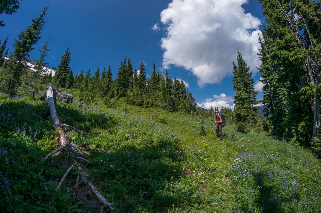
The hike was very moderate and the trail was both well-maintained (despite the heavy horse traffic) and very well graded. In fact, it seemed that we barely gained elevation at all. Anne and I took the “Old” trail that was called out in the new version of Peggy Goldman’s Washington scramble book. This in opposition to the “New” trail leading to Surprise Lake in the old version of her book.
(Photo by Anne Archambault)
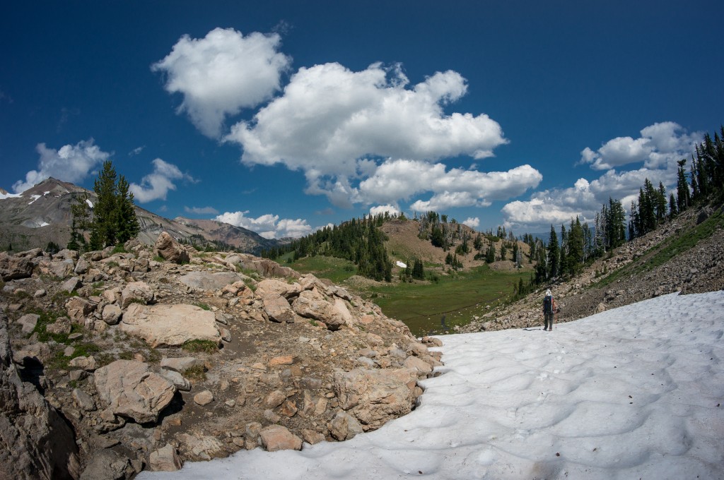
However, the pleasant grade changed abruptly once we reached the turn off towards Warm Lake. The path towards Warm Lake is marked by a cairn and a small path leading to the north that gains elevation steeply as it climbs away from the main Surprise Loop trail. The trail continues to gain elevation and travels (counter-intuitively) AWAY from Warm Lake until it gains a small plateau under a steep, somewhat cliffy hillside. The path continues away from Warm Lake, over the South Fork Tieton tributary, until it ascends steeply again making for a small col from which you turn left at the cairn and travel back towards Warm Lake following what could best be described as a game trail. You’ll again from the South Fork Tieton where the trail completely disappears and you continue overland up the hillside to reach Warm Lake.
(Photo by Anne Archambault)
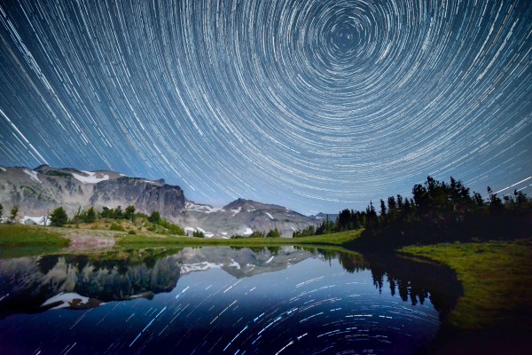
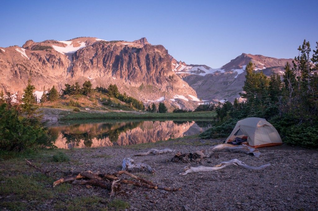
We had a grand campsite at Warm Lake that was well secluded, close to water, and afforded an excellent view of the cirque, the ridge, and our next morning’s summit. We ate well, rested our feet, and found a spot to hang our food for the night. In addition to the normal camp chores, we’d also brought a tripod and digital cameras, intent on doing some night photography and time lapse. The moon was set to rise around 11h30PM so I woke up around 10:30PM to set up my camera and leave it running for the rest of the night.
I was a little worried that my all night experiments might not have produced anything. In the end, I think the results are pretty cool and I was happy to work a little at my video editing skills.
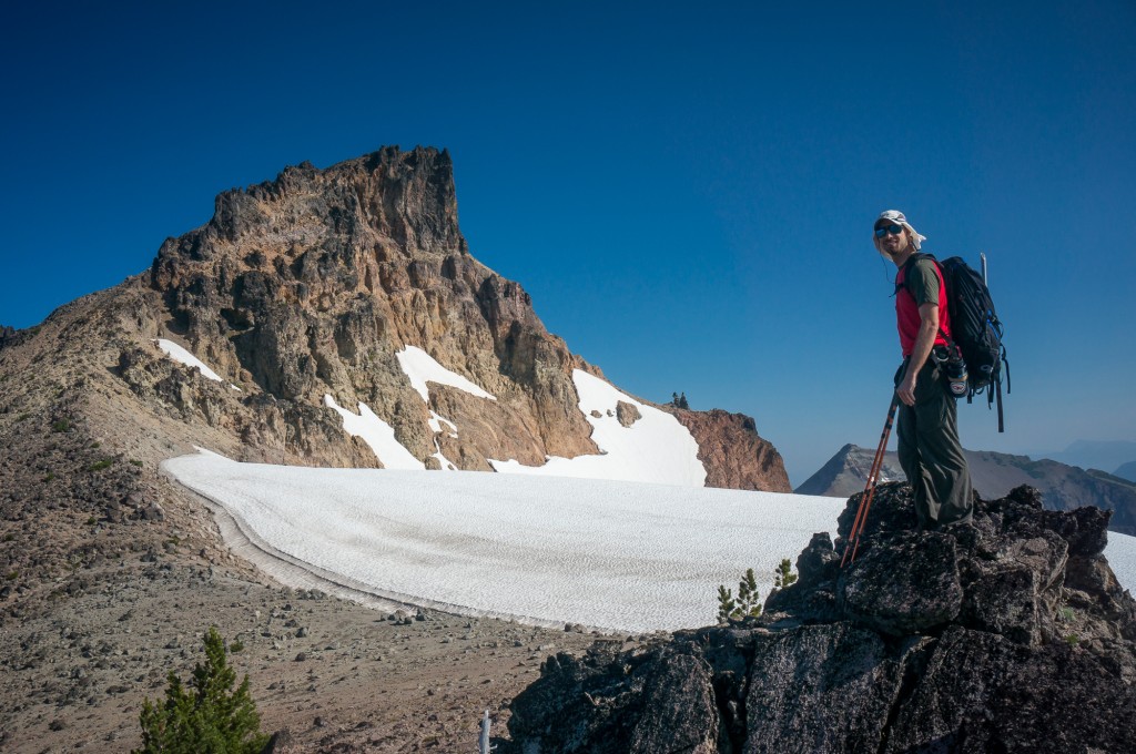
Our climb the next day took around 4 hours return to the summit. The trail was a faint and rarely used goat path that followed the obvious ridge to the shoulder of Gilbert.
(Photo by Anne Archambault)
This leads to an obvious traverse on the west side of the buttress to a point of weakness in the small but vertical bands of rock. The true summit was attained by heading nearly straight up. On the way up, we met another couple who had been leapfrogging us since we left the trailhead the previous day. They were Mazamas from Portland (Jonathan and Sandy) out for a weekend. We shared the final scramble to the summit, being careful to avoid rock fall as we made our way up the loose slope.
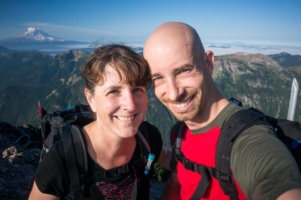
On the summit the views were grand as the Goat Rocks Wilderness was laid out before us along with Mt. Adams, Mt. St. Helens, and Mt. Rainier. We had Jonathan and Sandee take a picture of us rather than our generally mandatory selfie and then made our way back towards camp.
The trip out was uneventful even if it was long, dusty and hot. We stopped to refill our water bottles several times along the way and were glad for the various opportunities to grab fresh (and cold) water. By the time we reached the car around 5pm I was footsore and ready to devour a juicy burger.
(Photo by Anne Archambault)
Max elevation: 8191 ft
Min elevation: 3880 ft
Goat Rocks Wildnerness Backpacking Trip (Sept. 2014)
[…] Goat Rocks Wilderness backpacking. Near pacific crest trail in Washington […]